Language lessons

Friday 8 June – Hawes to Tan Hill Inn

Language is a funny thing. The English we speak is an amalgam of many sources, and when you travel through England you hear many dialects and local words, but what really brings it home are the place names.

Here in the North we come face to face with the Norse influence, still evident a thousand years later. Not so much in speech, though it’s undoubtedly there, but in place names.

Take today, for example. Our journey took us over Great Shunner Fell, through Thwaite and bypassing Keld. ‘Fell’ is a northern term for a high and barren mountain. ‘Thwaite’ means an area cleared for habitation, while ‘keld’ is a water source. The next couple of days will bring us more examples.

The next five days, including today, are some of the longest and hilliest of our entire walk. They will be challenging! But they will also give us some amazing scenery.

Today was a good intro, a 26km hilly walk from Hawes to Tan Hill Inn. In total we had 1000m of ascent (and 800m of descent) – that’s rather a lot!

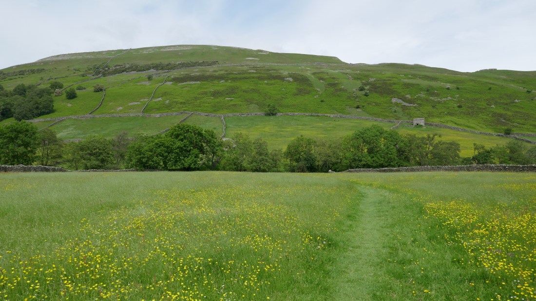
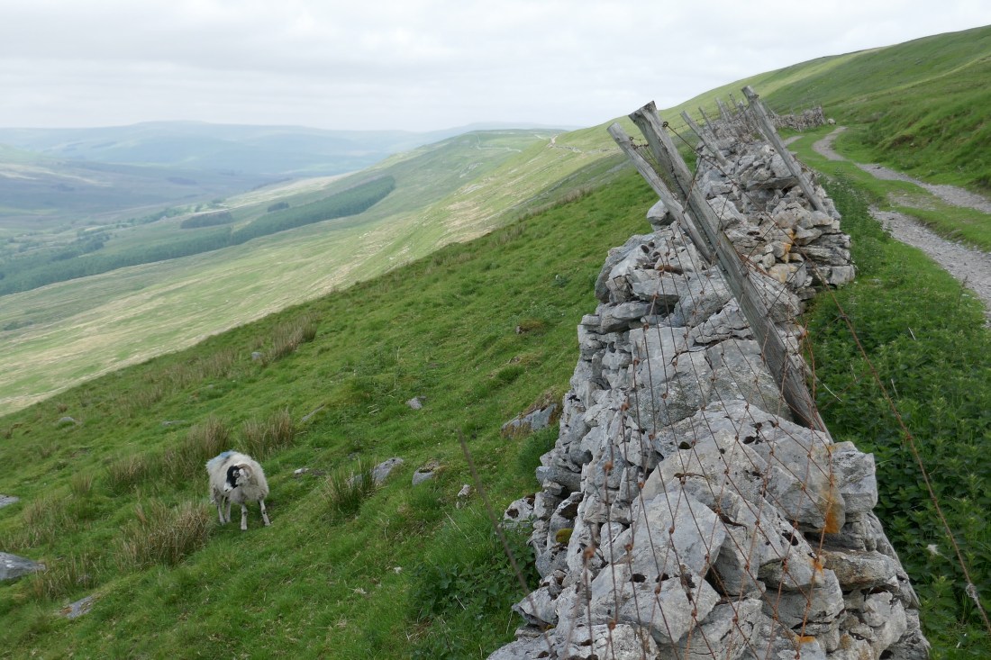
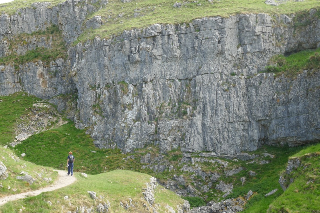
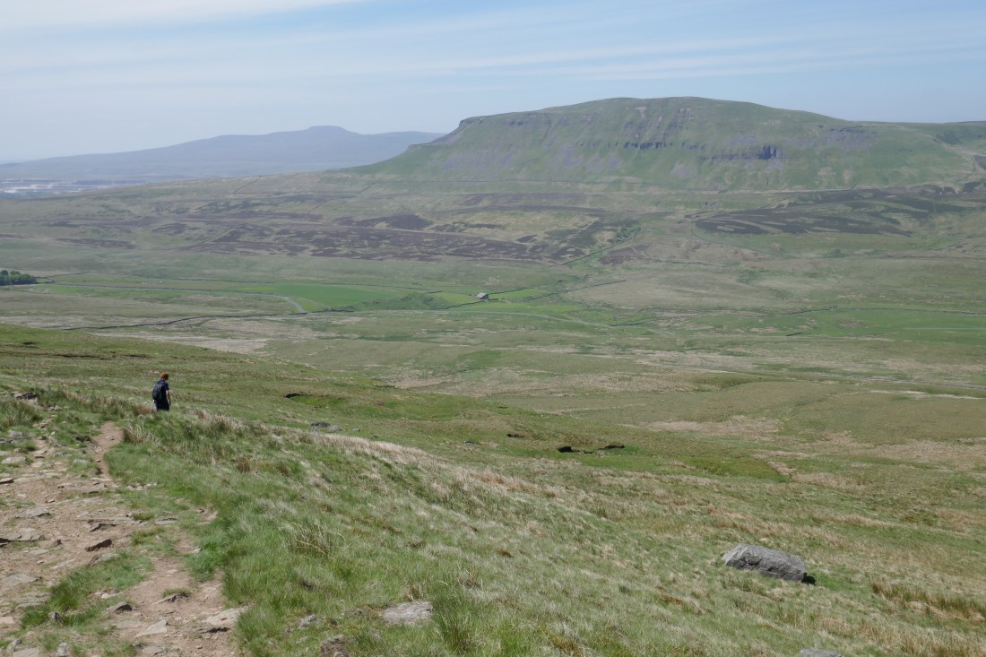
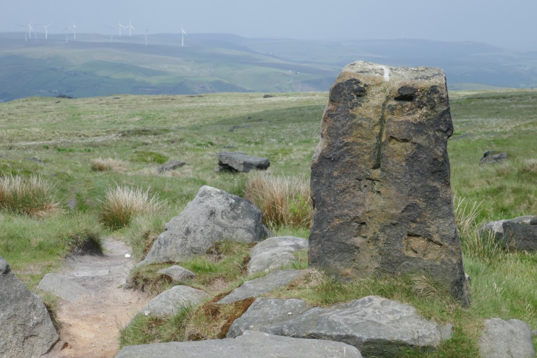
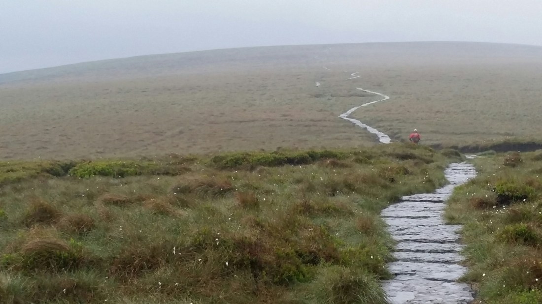
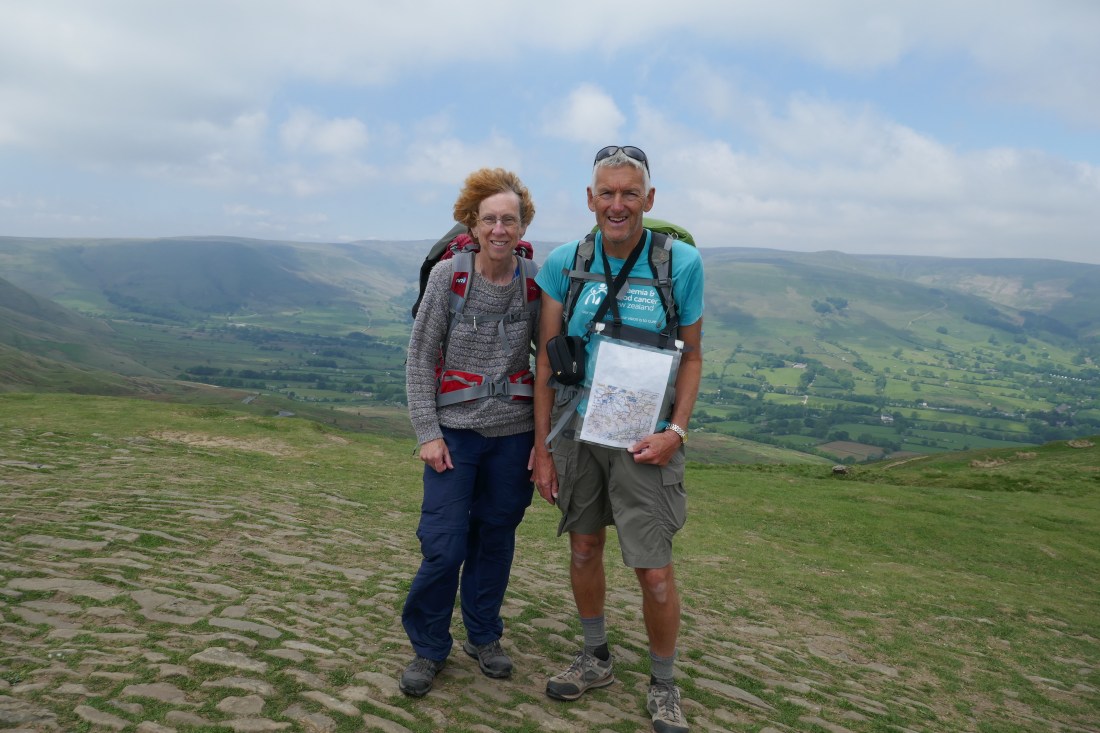
The start took us through the hay meadows behind Hawes and on to the village of Hardraw. So far, so simple, but then it was a two hour steady climb up and up, past stone-walled fields, out through moorland and up to the summit of Great Shunner Fell (don’t you just love the name?). At some 716m it’s the highest we’ve yet got to. The views leading up, back across Hawes, were just magnificent, and we really enjoyed the walking in the wide-open spaces. A bit of cloud kept the temperature down but it was a fine day and ideal for a walk.

At the summit was a well-designed wind break shelter in the form of a cross, so no matter the wind direction you could find shelter. We sat there for a bit, enjoying a snack and a break and the peace.

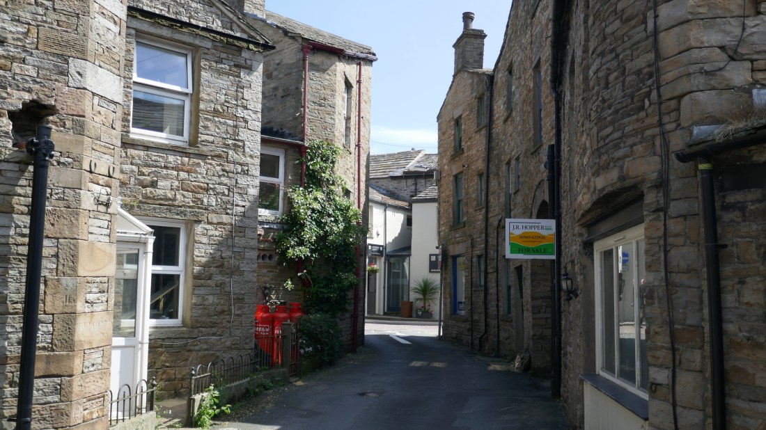
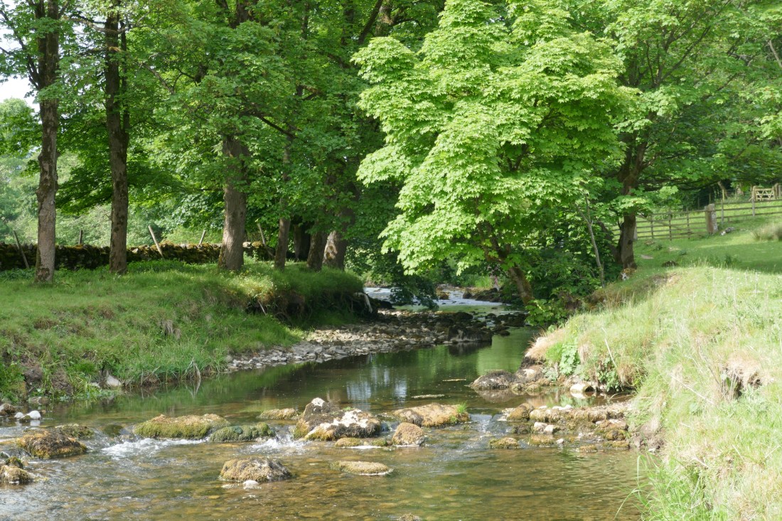
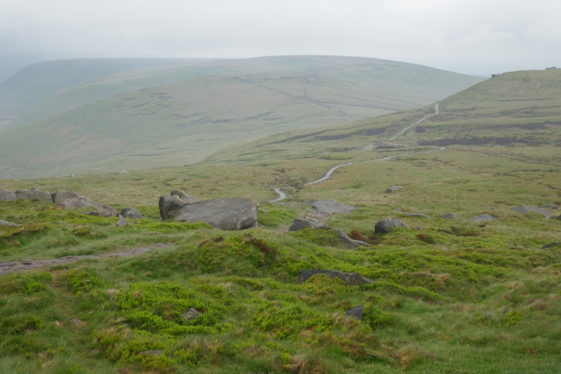
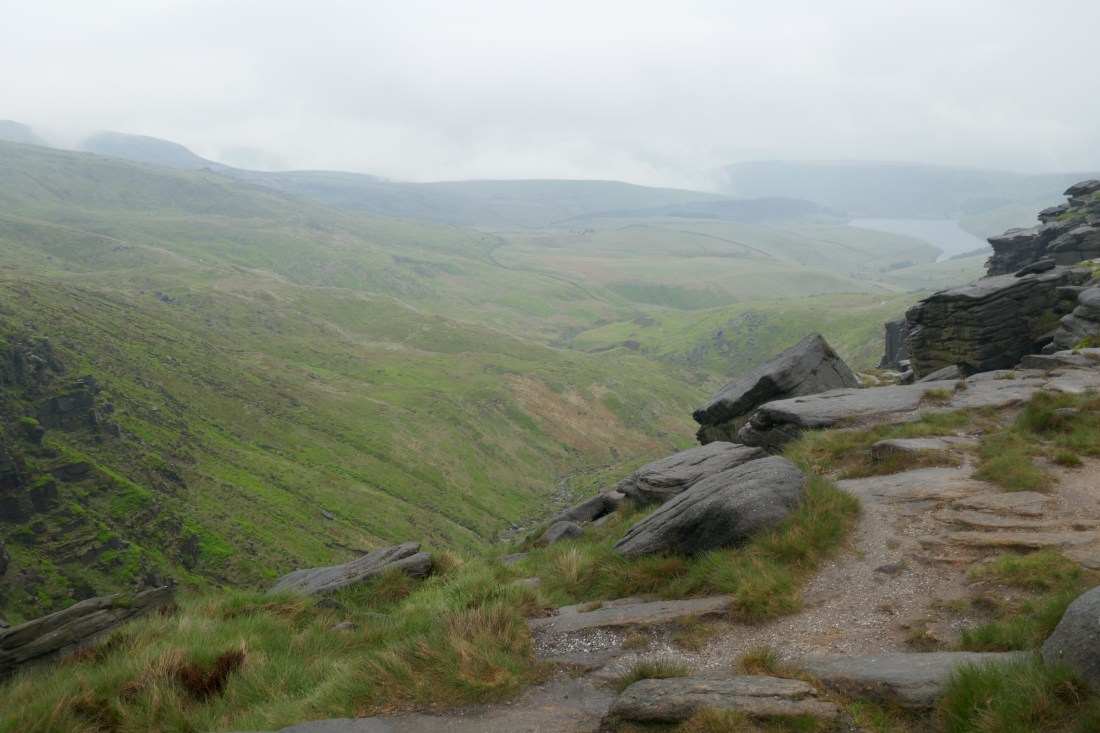
Over the hill brought us whole new vistas to west, north and east, down to the village of Thwaite. Actually getting there took a fair bit of walking, but our way was aided by stone slabs across boggier bits. By 1.30pm we’d descended and found a café – time for a coffee, lemonade and slice. Thwaite is a lovely little village with a surprising number of B&Bs, nestled in a small valley.

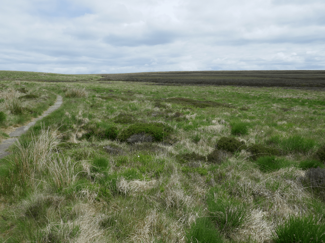
The next hour or so were a bit of a trial, up 200m, along a fairly rocky and narrow path, then down to near the village of Keld. Mind you, we were high up overlooking Swaledale – yet another dale – and were treated to some lovely views.

Bypassing Keld, we had a steep ascent, then out over farmland and moorland, the path gently rising with views out over a valley to our left. A final steepish up brought Tan Hill Inn into sight, our destination for tonight.

It’s in the middle of nowhere, off a minor road, but a popular destination for walkers and cyclists. It’s also the highest pub in Britain, at 528m. It even has its own snowplough parked outside – and it’s not for show! When we were making our bookings, there weren’t really any alternatives, but given that we are glad we are able to stay – it has a lot of character, and a great place to sit and chill out.

As we write this, the sun is setting, casting a golden glow over the surrounding moorlands. And yes, photos have been taken!

Distance today: 26km

Great Shunner Fell:

P1010285.JPG

Hay meadows near Thwaite

P1010297.JPG

More cheese, Gromit?

Wednesday 6 June – Horton-in-Ribblesdale to Hawes

Leaving our little country pub in the cloudy early morning, we set off along a lane just a few metres out of the car park to continue along the Pennine Way – very handy!  As always, the day started with a bit of a climb but a very straightforward route as we followed a stony track.  In fact most of today was along such tracks, with just a short stretch of grassy path.  So, easy progress although tougher on the feet. Most of the tracks were between dry stone walls but passed through some big expanses of moorland, so there were some fabulous views.

Our highest point today was near Dodd Fell, just a little under 600m above sea level (having started at about 200m, and also finishing at about 200m), and that involved a gradual ascent that took most of the morning.  Along the way we had views of the Ribblehead Viaduct – made famous in the second Harry Potter movie – and also of the three of the highest peaks in this part of Yorkshire.

A few kilometres out of Horton we passed Sell Gill holes, where a stream literally disappears down a huge hole in the limestone rock.  We passed a couple of other examples of this later in the day – quite weird, like a reverse spring!  There are lots of other larger holes and caves in the limestone in this area – our accommodation last night was across the road from the Craven Potholing Club.

We also walked over an old packhorse bridge – yes we know, difficult to guess the purpose from the name! – but strangely enough, an example of the type of bridge over rivers, or other obstacles, built specifically to allow laden packhorses to cross easily. So, no walls originally, as this might have restricted the pack size, and usually no more than six feet wide, and built between 1650 and 1800.  The one we crossed had walls, but these would have been added after 1800 once pedestrians started using the bridge.

Our long, gradual descent into Hawes took us through some very pretty meadows and through the neighbouring village of Gayle.

Distance today: 22km


Thursday 7 June – Hawes – rest day!

Hawes is a beautiful village set in the Yorkshire Dales. It’s about a kilometre long, with many attractive buildings along each side of the road, and sits in a valley between two fells, a scenic setting indeed.  Our room at our extremely welcoming and comfortable B and B, Ebor House, looks out over the fell behind the house – gorgeous.

We have had a day playing tourists.  For such a small place there was certainly plenty to keep us occupied.  We spent quite some hours out and about – visiting the nearby Dales Countryside Museum and learning so much about the past way of life in the Dales, then a working ropemakers, and also the Wensleydale Creamery where they make the famous cheese best known from Wallace and Gromit  (and some of which Peter had eaten with dinner last night!)All fascinating places.  After a coffee and cake (tough life) we strolled through the village in glorious sunshine, taking photos and generally enjoying a very relaxing day.

We were heartened to find that the Creamery, and their newer second nearby premises, are doing their best to be a sustainable business – using locally produced milk, recycling the water recovered from the whey during the cheesemaking process, using the heat produced by the refrigerators to heat the visitors centre.  We are also seeing a lot about reducing plastics and clearing plastic waste on various TV programmes / TV News, and have passed some little local nature reserves where replanting is taking place.  It is great that there does seem to be a bit of a groundswell amongst everyday folk to do their bit and try to maintain and restore the beautiful countryside that we have been walking through.

Hawes is a wonderful place to have spent a rest day in, and we could easily see ourselves returning to use it as a base for hill walking.

On the way into Hawes:

P1010264.JPG

Hawes

P1010254


Over the hills and far away

Tuesday 5 June – Malham to Horton-in-Ribblesdale

What a wonderful day!

When you open the curtains to a brilliant blue sky, it’s a great start. And it remained a great day, walking through dramatic limestone country with some of the best views so far.

Your intrepid explorers set off under sunny skies, fed and watered, striding up the lane out of Malham towards our first highlight, Malham Cove. Despite the name it’s not a beach; in fact it’s a limestone cliff, over which water once poured in a waterfall at the end of the last ice age. The water may have gone but it’s still impressive: a curved wall of rock at the end of the valley.

We have been to it before, back in 2005 when the four of us spent a few days in the Dales, and enjoyed our return trip, memories rekindled as we walked along the footpath up the valley, then climbing the stone steps to one side of the cliff, to arrive at the top for some superb views. The limestone at the top has been eroded over time into chunky blocks separated by fissures in which a variety of plants grow, lending it a chequerboard appearance. Peregrine falcons apparently are nesting but we weren’t able to see any today.

Time then to walk further up the narrow valley above Malham Cove, climbing steadily higher, a valley unusual in that it lacks any running water. We emerged at the top into rolling countryside and Malham Tarn, which despite its name is more the size of a small lake nearly a kilometre across. Its unusual to have a body of water of such size in limestone country as the water usually finds a way to percolate through the porous rock. It’s a rather lovely lake, with the Dales around it.

The Way led us partway down a wide farmed valley, typical of most in this area with its sheep and drystone walls, before ascending high up the slopes of Fountains Fell. We had wide vistas that seem to stretch on forever, heather and tussock around us bathed in sunshine, silent and peaceful, virtually windless, and virtually no sign of habitation, a truly beautiful place. The odd sheep could be seen, and a few people also walking the Way, but otherwise we felt a million miles away. We sat for many minutes munching on a snack and simply enjoying the peace and solitude and views.

Round the slopes of the Fell (actually a 660m high mountain) brought us the majestic sight of Pen-y-Ghent, a 690m high mountain and our next destination. Unfortunately, between us and Pen-y-Ghent lay (you guessed it!) a valley… pretty it may have been, but we still had to descend the slopes knowing every metre lost would have to be regained. We could see the steep, rugged sides and knew it would be an ‘interesting’ climb.

Fortunately, the ascent proved less strenuous than we’d expected. Having said that, there was one particularly steep bit towards the top which certainly was ‘interesting’ indeed (Val described it as ‘at the limits of my comfort zone’ and ‘more like mountaineering than walking’ !.) Finally, we were on top of Pen-y-Ghent (‘hill of the wind’), the highest we’d got to so far, and of course with some great views all round.

The mountain is part of the Three Peaks challenge, an annual event that sees competitors trying to go up three neighbouring peaks in the shortest time possible.  They must be mad!

The final part of the day saw us descend the western slopes along a seemingly-unending gravel path, to a farm track, and finally and thankfully to the small village of Horton-in-Ribblesdale. No internet, no mobile coverage, but the chance to sit in the sun outside the pub, enjoying a quiet drink and reflecting on one of the best days we’ve had since we started. Bliss!!

Distance today:  24km

Malham Cove:

P1010176

Watlowes Valley, above Malham Cove:

P1010185.JPG

Peter relaxing on slopes of  Fountains Fell

P1010198.JPG

Pen-y-Ghent in distance  (Val in foreground)

P1010203.JPG

Halfway there!

Monday 4 June – Colne to Malham

And we would walk 500 miles
And we would walk 500 more
Just to be the twits who walked a thousand miles
To fall down at John O’Groats’ door…

(or something like that…)

Yes, today we passed the 50% distance mark!  920km, 575 miles to be precise. And tomorrow is day 42 of the 83 total that we are taking to get from Lands End to John O’Groats!  So we are very happy to announce that are now halfway through our Grand Adventure!  (Yes, we are amazed too!). When we first started, it seemed like a VERY long way, but it’s amazing what happens when you just put one foot in front of the other, day after day.

As we had needed to divert away from the Pennine Way yesterday afternoon, to get to our accommodation, the first part of this morning was spent heading back to rejoin the Way.  We elected to follow some very quiet country lanes to accomplish this, and it made for rapid progress amid the peace of the outskirts of Colne. Passing through Earby on the way, we picked up the Pennine Way at Thornton in Craven, and followed it for a couple more kilometres until it picked up the Leeds and Liverpool Canal. This was a nice little treat for us, and although short lived, we enjoyed the contrast between this and the moorland yesterday’s route had taken.

The Leeds and Liverpool Canal is the longest of the English canals at 127 miles and one of the oldest, with construction started in 1770 and completed in 1816. It crosses the Pennines, and has 91 locks. Originally built to carry coal, wool, and other cargo, it is now a purely recreational canal.

We juggled between canal path, Pennine Way and minor roads through to Gargrave, where we had hoped to visit a café highly recommended in our guidebook – the Dalesman Café – and were bitterly disappointed to find that it is closed on Mondays! Our second café choice turned out to have closed down last year, so we were left with a pub for a coffee / lemonade and a consolation slice of a beautiful rich Chocolate Brownie for “lunch”.

From Gargrave we again mixed country lanes and Pennine Way to pass through Airton and Hanlith, eventually arriving at Malham at about 4.30pm. On our way through from Gargrave to Airton we got stuck behind a rural traffic jam – a mob of sheep being moved along the lane between fields by a farmer on his quad bike – quite entertaining.

Throughout our journey today we were amazed at just how many footpaths there are in this area – it really is a walkers’ mecca. The countryside is of course very beautiful and we are close to a number of large cities, so there are many people to take advantage of all these opportunities. Malham itself is very much geared around walkers – our accommodation tonight, The Buck Inn, “welcomes muddy boots”!

Tomorrow we start one of the wildest, most scenic and certainly the hilliest stretches we will do in our entire journey – travelling through the Yorkshire Dales. It promises to be epic!

Distance today:   28km

River Aire, near Malham

P1010169.JPG

It’s Wuthering Heights – so where’s Cathy and Heathcliff?

Sunday 3 June – Hebden Bridge to Colne – Day 40

Today we moved into Bronte territory.

After yesterday’s cloud we started the day in sunshine, walking up the Calder Valley, following the river through a narrow band of woodland for several kilometres. After the high treeless moorland of the past few days, it was a refreshing change.

As the woodland came to an end we climbed out of the valley, firstly back into farmland, past a couple of reservoirs, then higher into moorland to once again rejoin the Pennine Way. At one point we stopped for a while, sitting and enjoying the peace and solitude and views over the heather, with next to no wind. The warm air felt very humid, and the cloud thickened up, but no rain eventuated.

Our path took us over the top of Withins Height. In the distance we could see the village of Haworth, well-known for its Bronte connections, and not long after we passed the ruins of Top Withins farmhouse which, according to the signage, may well have been the inspiration for the setting of Wuthering Heights. The farmhouse itself is too small to have been the house described in the book, but the views are very close to those that Bronte wrote about. We looked in vain for Cathy or Heathcliff or even a Kate Bush warbling on, but to no avail…

Continuing down off the moor we passed two more reservoirs (my, do they love their reservoirs in this part of the country!). As the place we are staying at is off the Pennine Way, we had to abandon it for a while and instead pick up the Bronte Way, echoing the Bronte sisters’ regular trips along wild paths to Lancashire.

At first it was a very rough and haphazard path, and we decided to “do the road thing”. After five minutes of dodging some very fast vehicles and with the encouragement of one motorist, who actually stopped her Landrover to tell us how dangerous that stretch of road was (‘they drive like maniacs’), we wisely abandoned it and rejoined the Bronte Way. Fortunately, from that point on it was a very good path. We followed it down a valley, alongside a stream, then through the village of Wycoller and on to Laneshaw Bridge at the east of Colne, our destination.

We had known nothing about Colne or indeed the area of Pendle, but were interested to read about its fascinating history. In 1612 a number of men and women were accused of witchcraft, found guilty at a trial, and subsequently hanged. It appears to have been quite a famous case, though we were unaware of it prior, and to this day a number of businesses reference it. There is another walkway, the Pendle Way, which shadows the Bronte Way for a while, and whose symbol is a witch on a broomstick.

It also appears that Colne is a real centre for live music and events and is increasingly compared with Hebden Bridge.

It’s amazing how much there is to learn about and experience in even the most apparently out-of-the-way places!

Distance today: 26km

Going up Withins Heights

Withins Heights.PNG

A Day In The Life

Saturday 2 June – Hebden Bridge

Rest day! Oh what bliss those two words mean….

Because of a late unexpected change in accommodation we’ve had to stay in two different places, but both hosts have been really accommodating about either storing our packs for a while or letting us have early access.

After Skyping Genevieve we spent a very pleasant three hours wandering around Hebden Bridge. This is not our first visit, having been here with the girls back in 2005, and we remembered how charming this large village is, so were delighted to renew our acquaintance. Most of the buildings are of the local gritstone, which starts off slightly darker than the pale stone of the Cotswolds but develops a darker sooty colour over time. The commonality gives the village a real sense of visual coherence. As it’s in a fairly deep valley it has a feeling of closeness about it.

With both the Calder River and the Rochdale Canal running through the village, there’s plenty to add to its character. We spent an hour at one point at a café by the cobbled Market Square, simply watching the world go by, resting our feet while other people used theirs! With a number of walks and lovely places to visit in the vicinity, it’s definitely on the list of places we’d like to return to.


As well as it being a rest day, we thought it’s a great opportunity to describe what a typical day ‘on the trail’ looks like. Every day is different, of course, but they have some common features, and by now we have a fairly well-established routine. So here is A Day In The Life.

We start with getting dressed (who’d have guessed?) and maybe a bit of sorting out, then it’s time for breakfast. Generally this is from 8am, though in a few places we’re able to eat earlier. Most places offer cooked as well as continental breakfasts. Through trial and error, we’ve settled on muesli and toast for Val, and muesli and a stripped down cooked breakfast (and a decently strong coffee!) for Peter. Packing up afterwards doesn’t exactly take hours – after all, what came with us goes with us, and by now we know what best packs in where.

On a few days, such as through the Pennines, we use a pack transfer service, but most of the time we’re carrying everything.

We set off about 9am, with the map of the day’s route in in our waterproof map holder plus (where we have one) a guidebook. We’ll often walk till around midday, with Val having snacked on a muesli bar along the way. Ideally sometime from now a café or a pub will hove into view, an opportunity for Peter to satisfy his caffeine craving, a cold drink for Val, and hopefully a slice or a piece of cake. Frequently there’s nothing available so we make do with snacks we carry such as biscuits or crisps or fruit.

We’re fairly set after that. Peter has found the cooked breakfast carries him through the rest of the day, whereas Val is more likely to snack as she goes along. Both of us will have a chocolate break mid-afternoon if our energy is flagging!

Our ideal distance is around 22 to 25 km, which we can do comfortably and still arrive at our destination by around 4 or 4.30pm. Much longer than that, and we start to slip into ‘destination mode’ where the arrival at the destination is much more appealing than the journey itself. If we’ve got there by 4.30 it gives us a chance to freshen up and relax into pre-dinner mode. This would include writing up our blog (and, wifi permitting) posting it. With some of our later arrival days, we’ve basically had to drop our packs and go and get dinner.

Typically after dinner, we don’t want to do much, we just want to relax, texting updates to family, maybe the odd email, reading or watching something on TV. By 10pm we’re generally dozing off, so it’s time for sleep…

Repeat again tomorrow!

View from our bedroom window:

P1010107.JPG

Hebden Bridge street:

P1010121.JPG


The One With No Catchy Title

Friday 1 June – Diggle to Hebden Bridge

The forecast for today hadn’t been too promising: extensive cloud (ie fog for us), and possible thunderstorms for the afternoon. So it was a surprise to have the sun greet us in the morning with plenty of blue sky.

Unlike the past few days, today didn’t start with a climb out of a valley, for we were starting off relatively high up. We were glad about that! It was straight out and into moorland, following the Way northwards along the edge of an escarpment, past Close Moss and Castleshaw Moor, up and over the heather-clad White Hill. Far below us, off to the west, we could see a number of reservoirs, watering Manchester and its satellite towns.

After a couple of hours of stillness, the peace was shattered by the M62 motorway, its six lanes of noise a real assault on the senses. We crossed it on a rather beautifully-designed arched bridge, constructed especially for the Way when the motorway was built. Apparently the head of the project was a keen walker and wanted to ensure fellow walkers had a fitting crossing.

Leaving the motorway and its noise took some time, but eventually we were once again surrounded by rolling moorland and just the occasional bird call. At one point we passed the Aiggin Stone – an ancient marker stone that has been guiding travellers for about 600years. The path took a short diversion, going along an ancient packhorse road. Our book said the reputed Roman origins of the well-worn stones that paved it was ‘unproven’, but we liked to think they were the real thing.

By coincidence we passed a pub around lunchtime – time for a coffee and a delicious piece of apple pie. Suitably refreshed we progressed along probably the least interesting part of the day, a gravel track passing several reservoirs, originally constructed to provide water for canals but now principally a source of water for Lancashire.

For some time we could see a tall monument, Stoodley Pike, high on a headland overlooking the Calder Valley.  It was built in 1815 to commemorate the defeat of Napolean at Waterloo. Although it collapsed in 1854 it was rebuilt, and at 120 ft (34m) tall it is a landmark that can be seen from miles away.  Also, it apparently marks a change in the landscape too – with the peat moors and gritstone to the south and the limestone and more pastoral areas to the north. We sat on a grassy slope below it, enjoying the panoramic views, before descending to the valley and following the Rochdale canal into the village of Hebden Bridge and our accommodation, The Smithery.

Distance today: 24km

Below: the Aiggin Stone

P1010094.JPG

What a difference a day makes

Thursday 31 May – Torside to Diggle

What’s that ?  Sunshine ?  Yes – it is! Fabulous!

Although it started out cloudy, by the middle of the day we did have some sun, and indeed at times, out there on the exposed moorland, we were hoping the cloud might return for a while so we didn’t get too hot!  There is just no pleasing some people!

But what a difference indeed that it makes to the Pennines.  In the rain and mist it is just so bleak; but bring out the sun and it is transformed.  And even Val freely admitted that it really is beautiful and dramatic scenery on a sunny day!

We left our very comfortable B and B, The Old House at Torside, and walked the 3km back along the road to rejoin the Pennine Way.  Within the next 2-3km we climbed about 300m to wind up on a narrow path precariously following the contours of an escarpment, feeling almost literally on top of the world.  (It reminded us a little of the South West Coast Path except fortunately without the wind!) Down in the valley was the Crowden Great Brook which we followed for a couple more kilometres, before leaving it to climb a little further through moorland to the top of Black Hill, at about 580m our highest point today.  We then dropped down a little to wind our way towards Standedge and Diggle between a series of hilltop reservoirs.

It was quite a varied day – streams and valleys, more peat bogs traversed atop giant slabs of stone, steep climbs, steep descents (then more steep climbs of course!), plateaus covered in heather and cotton grass (so called as the flower looks like raw cotton). At times all we could see for kilometres were the gently rolling moorlands, and we felt a long way from anywhere, even though we are not actually that far from Manchester or Huddersfield. And not a drop of rain!

The navigation for today was quite straightforward fortunately, and that also helped make the day more enjoyable.  A few other walkers out and about too, including Steve whom we were never far in front of or behind again today. Towards the end of the day we passed several shallow reservoirs, which we later learned provide water for the canal system hereabouts.

Today was a little shorter than yesterday, and by just after 3.30pm we were leaving the Pennine Way to head off towards our accommodation for tonight, Sunfield B and B at Diggle (love the name!).  Diggle is a good 2km away from the Way, but happily our lovely host, Bill, has already said he will drive us back to rejoin the path after breakfast tomorrow!  And again we are really pleased with our B and B – very comfortable. Diggle itself is at one end of the trans-Pennine canal tunnel, finally reopened only a few years ago – at 3.5 miles it’s the longest canal tunnel and the highest navigable waterway in England.

And so, yes, you guessed it – off to the local pub, The Diggle Hotel, for an excellent burger….. oh, and may be a drink of an alcoholic variety. Back in time to watch that absolutely brilliant UK show, ‘Springwatch’. It’s a tough life….

Total distance:  21km

P1010076.JPG

We start the Pennine Way!

Wednesday 30 May – Edale to Torside

So, here we are. The start of the Pennine Way.

As we’ve commented before, we knew the Way would be a challenging walk. We had read a lot about its changeable weather, the navigation challenges, the ups and downs, as well as the beautiful scenery. We’d also read that a lot of people give up after this first day. So it’s fair to say that we were both excited and a bit nervous as we set off this morning!

Today was a 27km walk, up to Kinder Scout, along a plateau, then down to the Torside valley.

We started off in good spirits, knowing our packs were being transported and the weather, though cloudy, was dry. The forecast was for a lot of low cloud (translation: mist up in the hills!) and a high likelihood of some showers. The first part of the day took us along the Edale valley, slowly rising along the way. Looks good, we thought. Don’t be fooled, said the guidebook. Sure enough, after a while the easy part finished, with a steep climb up Jacob’s Ladder, essentially a stone staircase, then along to Kinder Low, which despite its name is actually a peak! At just over 600m high it may not be Everest, but it was the highest we’d got to, and it gave us grand views back along the Edale valley.

Then the rain began.

Then the cloud closed in.

The rest of the day was basically rain, cloud, fog and drizzle. Our guidebook kept describing “magnificent views to the west”. Yes, we had magnificent views – of low cloud and raindrops. Such a shame particularly at the end of the walk when we walked high along a river valley, which should have been so picturesque but we couldn’t see more than 50m away.

Our biggest concern for today had been navigational challenges at a couple of points. Fortunately, by chance we wound up walking much of the way with Steve from Bristol, who had done the Pennine Way twice before.  It also helped that the Way was better marked than we had expected.

On the plateau itself we were walking for a long time across peatlands, originally forested but cleared 7,000 years ago and since becoming peatland and heather. It had a wild beauty all of its own. Fortunately the peat bogs that had plagued earlier walkers have now been tamed in most areas with huge stone slabs that have been repurposed from demolished stone buildings. This not only helps walkers such as ourselves but helps protect the peatland environment.

It sounds like a pretty grim day but in fact chunks were very enjoyable.

It’s fair to say that we have slightly differing opinions on a day like today. Peter really enjoys the wild remoteness of areas such as the Pennine uplands, even when wet and cloudy, in part because he has experienced this sort of walking back in NZ. Val on the other hand isn’t so keen, and definitely prefers more lowland walks such as the Cotswolds. Just as well we have a lot of variation on this Grand Adventure!

Both of us though were delighted to descend into the Torside valley, to our accommodation at The Old House B&B, and be welcomed with hot drinks. The hot showers that followed were bliss!

The forecast for tomorrow is much better and it will be a shorter route with no navigational challenges. Roll on the sun!

Distance today: 27km

P1010050.JPG

PW day 1.jpg

P1010052.JPG


Up hills and down dales

Tuesday 29 May – Miller’s Dale to Edale

While our LEJOG walk is incredibly varied, we have always anticipated that the Pennine Way would be its most challenging section. For weeks it has been somewhere in the distance, but  now we are face to face with it – for tomorrow, here in Edale, it starts.

Fortunately, today’s section was (by our standards) relatively short, a mere 18km. However it did contain a couple of steep hill climbs. Contrary to our expectations, though, it proved to be a lot more straightforward and easier than we had thought.

The morning dawned to a cloudy, misty start, but the mist soon lifted as we slowly ascended out of Miller’s Dale. Our first village – in fact, the only village all day – was Tideswell, nestled in the slopes, a village of real character and charm, but also well-provisioned with at least two pubs, churches and even a couple of cafes. This surprised us at first but then we realised the area is a mecca for walkers. We saw yet another repurposed phone box, but this one really took the biscuit in terms of lateral thinking – the phone and dial actually called up various spoken commentaries on the history of the area. Truly inspired!

We walked out, up a quiet road and out onto a gently rolling landscape, all drystone walls and sheep under great big skies, just what we imagined it would look like. At first we were alone, then first one walker appeared, then another, then small groups. As we headed towards Mam Tor, at 500m the highest hill in the area, walkers were converging from all directions, till there must have been hundreds of people.

Was it a special event? No – it’s school holidays, good weather, and late spring, and the views are outstanding. It’s so popular a walk that the path up and down Mam Tor has been paved with local stone. We could see why it was so popular when we got to the top, with its breath-taking views. To the southeast we could see the village of Castleton down in a valley, to the north the valley of Edale – and behind it, the bulk of Kinder Scout, our first challenge for tomorrow. We fancied we could even pick up the Pennine Way’s track across Kinder Scout’s slopes.

Then it was down to the valley, to the Rambler Inn in Edale, our accommodation for tonight, a wander up to the Nags Head Inn (the traditional starting point of the Way), then back for dinner.

From all our reading, we know the next few days will be challenging, both in terms of the hills and also the navigation in a few places. However we have elected to use a pack transfer service so we will need only daypacks; we are well-equipped with maps, a guidebook and a compass; and five weeks of walking has toughened us up somewhat. Let’s hope for good weather!

Distance today: 18km

Peter and Val atop Mam Tor:

P1010042.JPG