Rest day!

Tuesday 3 July – Fort William – rest day.

Rest day! Rest day! Oh how sweet the sound of those two words!

Especially as it was the last rest day we’ll have til the end of Lands End to John O’Groats.

Originally we were scheduled to have two more – tomorrow, here, and on Sunday in Inverness. However, the following days are both long ones, so we’ve opted to in effect split them, doing some of Thursday’s walk tomorrow, and a similar thing in Inverness.

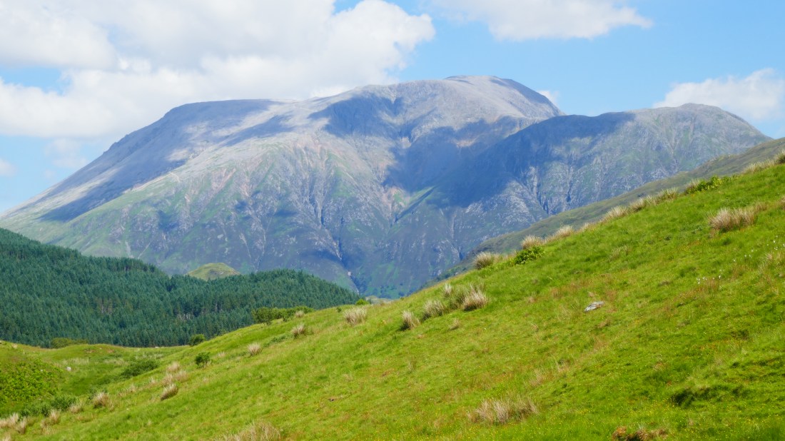
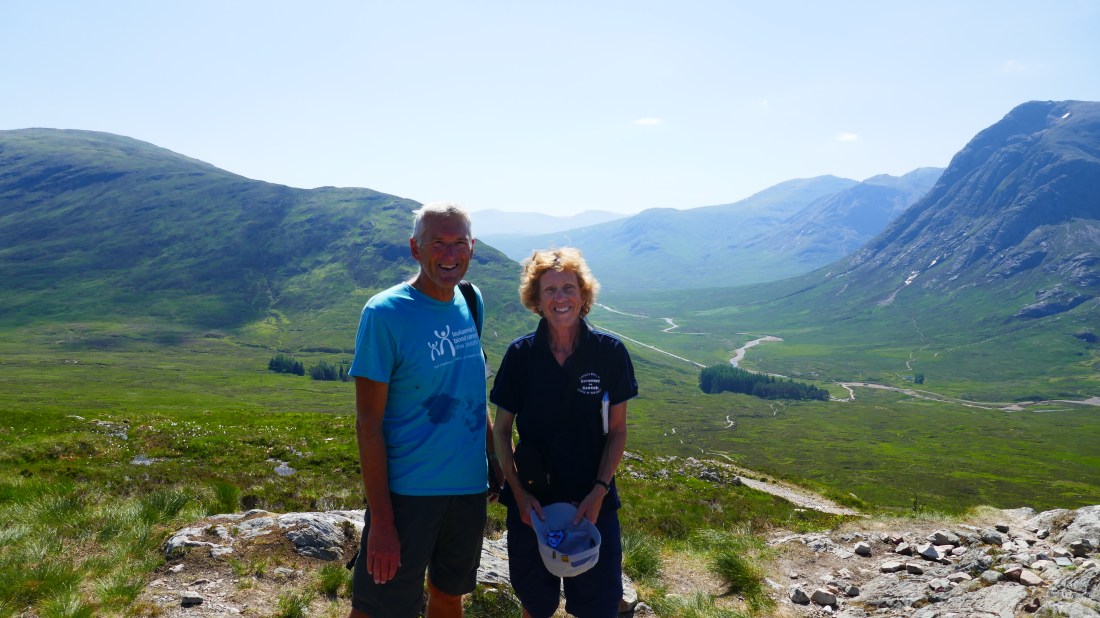
The main reason we’d originally booked in two rest days here was that Peter was keen on climbing Ben Nevis, at 1345m the highest mountain in Britain, and lying conveniently on Fort William’s doorstep. Not for nothing did Peter get the nickname ‘Peter Climb-every-mountain Lee’! However… in the end he decided not to. (Val, of course, was never going to!)

Partly it was a risk mitigation thing. Going up 1300m is one thing- tough but do-able. Descending 1300m, down a steep path, is quite another thing, and if you’re going to have any knee issues it’s during a descent. While the odds were low, they were still there, and given our goal is to reach John O’Groats, it simply wasn’t worth the risk of injury.

The other reason – one he shares with Val – is that he has almost reached ‘peak walking’. After ten weeks of almost constant walking, we are getting a bit weary, and to add in another 6 hour hard slog had little appeal now.

Each day still brings its pleasures – beautiful scenery and (currently) glorious weather – but it’s fair to say that we are more and more looking forward to finishing the walk. It’s a physical challenge, of course, which we fully expected, but it’s also been hard in other ways that we did not predict. To be continually on the move, spending nearly every night in a different room, packing up each morning, is tiring. Eating out every night has also lost its novelty – we are really craving getting back to some good home cooking! Of course the choice of beers and ciders won’t be so extensive back at Chez Mountbatten ……… But not long to go now – only 13 more walking days.

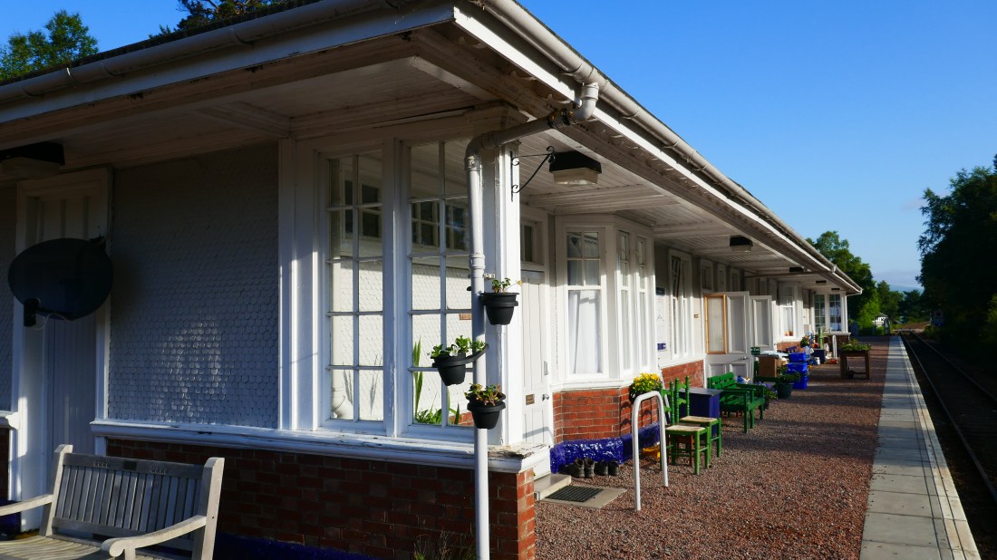
So today, our last rest day, we treated ourselves, getting a few things in Fort William, chilling out in the afternoon heat, then catching the train to Mallaig and back. It wasn’t so much for Mallaig itself – Mallaig’s a small port on the west coast, a key point for ferries to Skye, but not a lot else  – but because it is at the end of the train line from Glasgow and there would be some lovely countryside. Both of us adore long-distance trains, and the thought of simply sitting on one, watching the scenery come to us instead of the other way around, was too great to resist. And so we did just that!

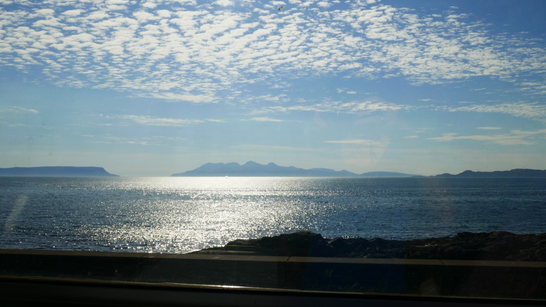
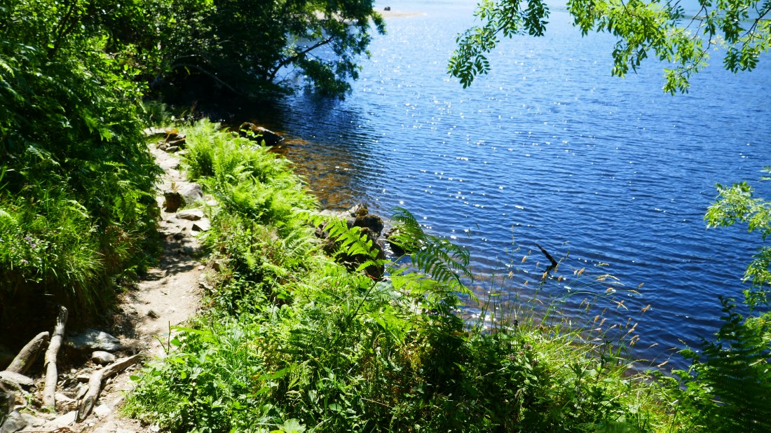
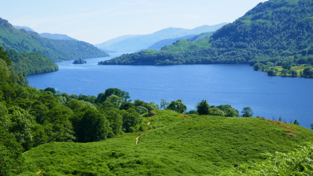
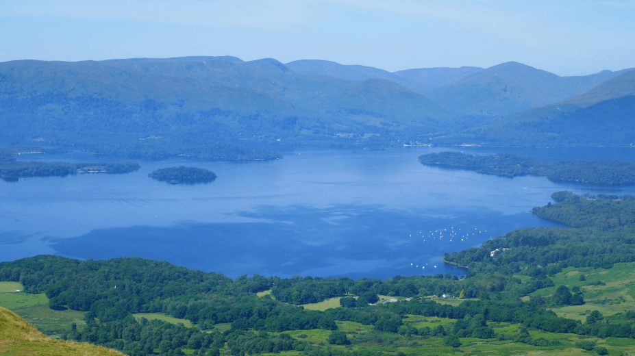
Along the way the line passes over the great Glenfinnan Viaduct, famous from its use in a Harry Potter movie, and the line and bridge curve quite conveniently so you can get some great photos – so everyone of course does, including us. We had an hour in Mallaig, which we spent sitting on the rocks overlooking the sea, looking out to the islands of Eigg and Muck and Skye, alluring and mysterious.

Our trip back was on the Jacobite, a steam train service – or would have been had the railways not ruled that the risk of fire was too high. So it was an ordinary diesel that took us back to Fort William.

We found a lovely little pub for a late snack, were charmed by the superbly-talented guitarist who was their music gig for the evening, and of course England got through to the next stage of the World Cup. A great end to a great rest day!

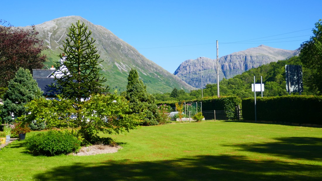
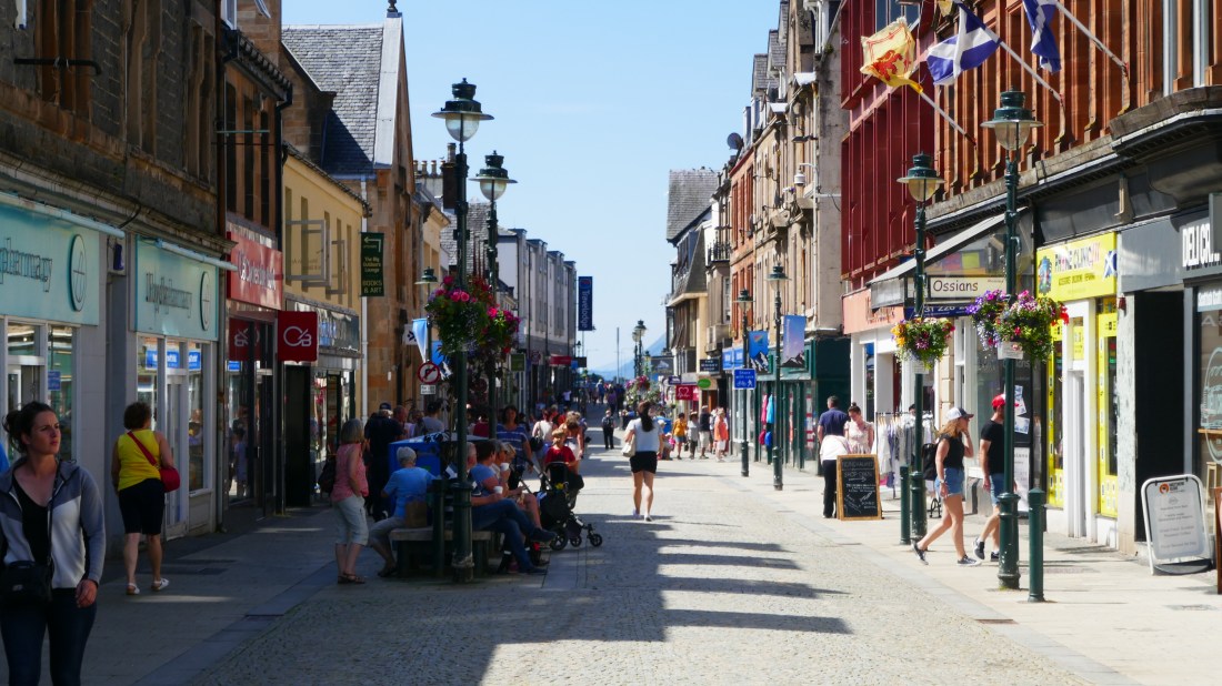
High St, Fort William:

P1010898

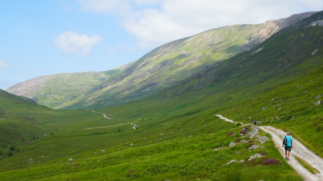
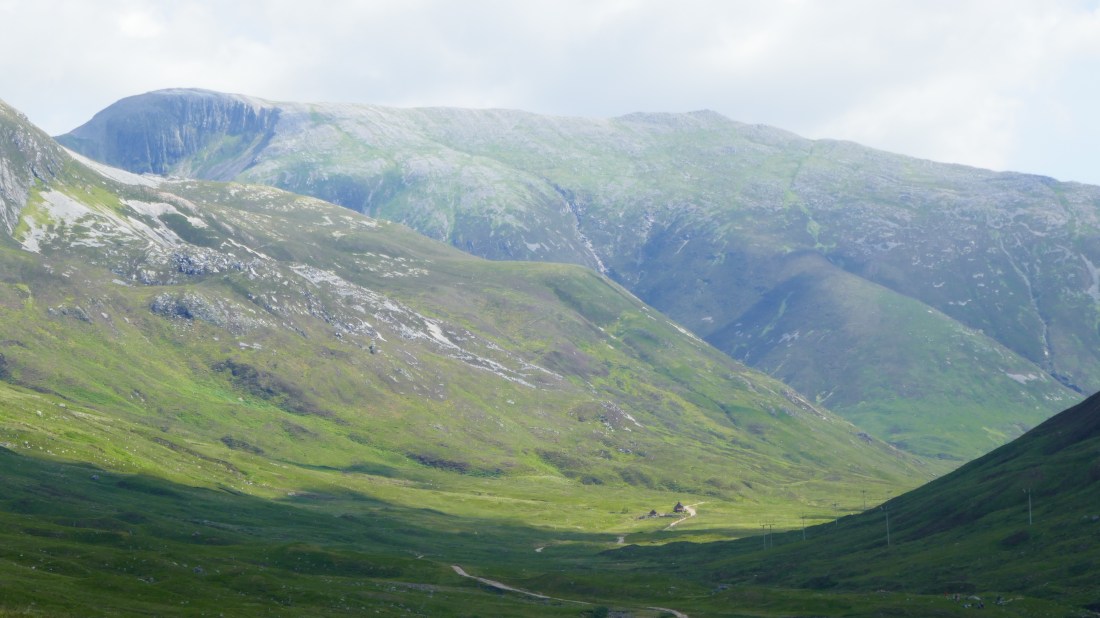
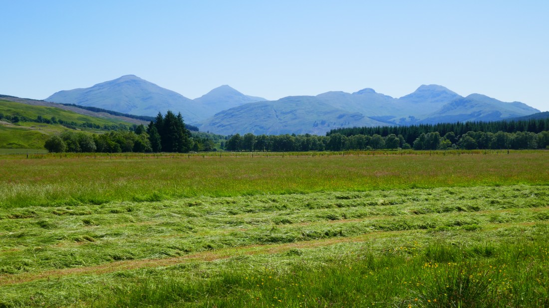
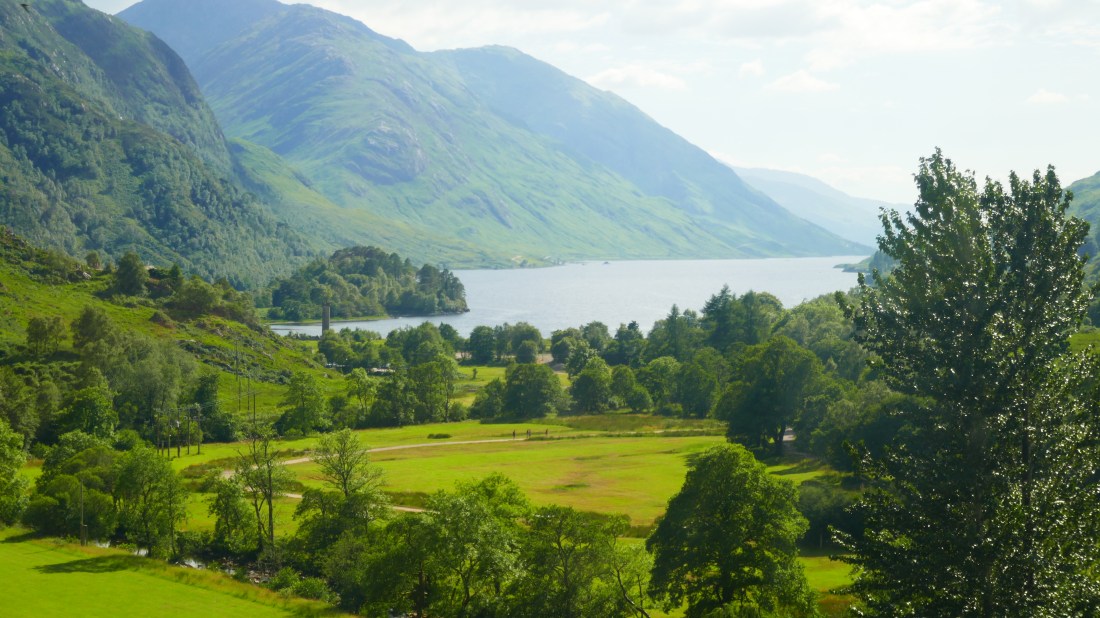
On the way to Mallaig:

P1010913

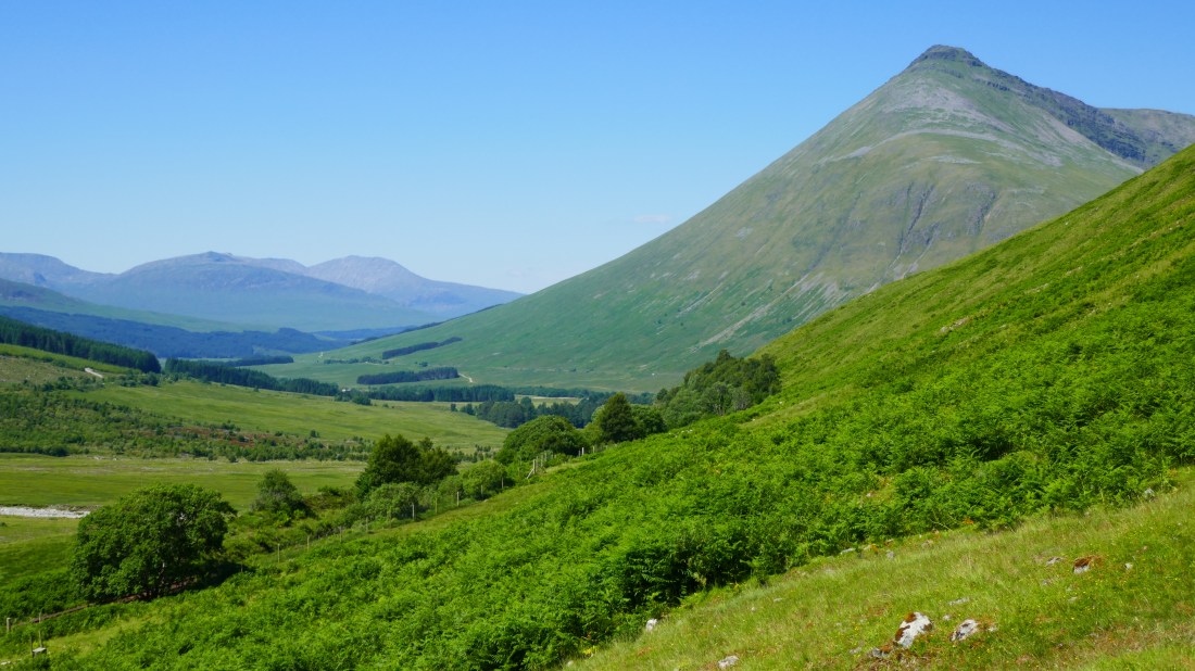
West towards Eigg and Muck

P1010924


Who needs Switzerland?

Monday 2 July – Kinlochleven to Fort William – Day 69

Sad to leave our very comfortable Ghlasdruim B and B at Glencoe, we set off at 9am to catch the bus out to Kinlochleven, about 15 minutes away. This was where we rejoined the West Highland Way path for the last section in to Fort William. Being another hot and sunny day, we were very glad to have made a last minute decision to have our packs transported again today. The added weight of the pack does make a huge difference to the enjoyment (or not) of the day when the temperature and the distance are in the mid 20s.

The first half hour was a reasonably steep climb up and out the back of the village to join another old military road which we were to follow through a glen, the valley of the Allt Nathrach river. Though steep, it was a well-maintained path, and at the top we had great views back over Kinlochleven. We didn’t linger long though – the horseflies were out again! The path wound along a little, past the site where a new extra hydro plant is under construction, and then….

Wow!  Again.  Yes, second time in two days!  As we came off a slight curve in the path, there ahead of us lay a beautiful valley, a small stream at its bottom, the path winding along, high peaks on either side. Both of us were instinctively prompted to comment that this is what we would expect from somewhere like Switzerland rather than Scotland! Well, maybe the Alps are a wee bit higher, but if you were to add a few chalets and a bit of snow and perhaps someone yodelling we think it would be close!

It was great walking, a good reasonably level track, fabulous views – just gorgeous. And it continued on for about 7km / 4 miles, about 2 hours walking time. There was a slight breeze too, which kept the temperature bearable and the flies minimal. Along the way were some ruins of old farm houses – it has to be said that it would have been a tough existence out there especially in the harsh winter conditions. A few sheep still graze in the valley but no current dwellings to be seen.

We would have been happy for this scenery to continue right through to Fort William but of course all good things end.  And this did in spectacular fashion.  At the end of the valley the path swung round and entered a forestry area and passed through clear felled areas which really just looked fairly desolate after the beauty of the morning.

At this point the official Way path heads up through the conifer forest and over a hill and then winds it way down to Fort William, along the pavement of the A82 for the final 2 miles. We elected to take an alternative route -a quiet country road that circled round the aforementioned hill, stayed away from the conifer forest and gave great views of Ben Nevis before entering Fort William. As we have said before, we are not wedded to completing every inch of any particular path – just completing LEJOG. Ben Nevis is indeed a stunning sight – the highest peak in Great Britain. No snow at this time of year, its bare shoulders certainly tower above the surrounding peaks.

And so into Fort William and to our accommodation for the next three nights. Originally we were to have two rest days, but having rethought that we are having one rest day and then splitting our rather lengthy next walking day by completing part of it on what would have been rest day number two.

Distance today: 24km / 15 miles

P1010871

Above and below: our favourite glen

P1010892

Ben Nevis:

P1010895


Spectacular!

P1010834

Sunday 1 July – Kingshouse to Kinlochleven – Day 68

Sometimes what looks like an ordinary day can instead yield a big surprise. Today was one of those days.

On paper, it didn’t look a lot: a short 18km day with a level bit along the busy A82, then an uphill bit (scarily labelled the Devil’s Staircase), over a saddle, and down to the village of Kinlochleven, described in the book as an ‘ugly, modern village’. Hmmm…

After a delicious breakfast – such a contrast to yesterday’s – and a short 14km taxi ride, we were back to where we’d been picked up yesterday, by the skifield turnoff in the middle of Glen Coe. We crossed over to join the way, going past the still-closed Kingshouse Hotel (which looks like it will be impressive when the makeover is finally done). The Way did indeed parallel the road, but at a respectful distance, and the scenery around us was well worth it, dramatic hills to both sides.

After 6km the Way met the road, and a busy carpark full of cars. We could see many walkers in the park and going up the track; being a Sunday and brilliantly sunny it was clearly the place to go! Ahead of us we could see perhaps a couple of dozen people, the party near the top appearing like minute multicoloured ants.

Our route now took us away from the road and up a steep bit of track largely following the old military road. The top part, the Devil’s Staircase, while steep wasn’t as bad as the name suggested, though the hot morning sun did make it a bit unpleasant. In a remarkably brief period we’d reached the top, at 440m the highest point of the West Highland Way.

We turned around, facing the way we’d come, and WOW!

In all the walking, the only view that was as grand and took us as much by surprise was High Cup Nick along the Pennine Way. This one was just as breathtaking. We were high on a ridge overlooking the great glacier-carved valley of Glen Coe, mountains well over 1000m high lining both sides. In the valley far below was the A82, the vehicles at this distance appearing tiny. Directly opposite, to our right, was the great 1100m massif of Buachaille Etive Mor, a narrow steep trail up its flanks just discernible. To our left, to the east, lay serried ranks of other mountains, way into the distance. Just gorgeous!

So we did the obvious – lots of photos and – we have to admit it – even a selfie!

After that, the rest of the day was a bit of an anti-climax, the trail taking us northwards across the pass to the adjoining valley. It was a bit rough in places and we had to pick our way carefully, but were rewarded with yet more great views to the north and east. In the distance was the Blackwater Reservoir, stretching many miles to the east, built for a hydro scheme in 1909 and the largest in Europe at that time.

Descent was relatively easy but it also reacquainted us with the pesky horseflies, so we were glad to reach the end of the day, the small town of Kinlochleven at the head of Loch Leven.

The town was originally built in the early 1900s to house workers at the aluminium smelter, the reason for the hydro dam. While the smelter closed in 2000 the village has successfully reinvented itself as a centre for all sorts of outdoors pursuits. The guide book described it as ‘ugly and modern’ but in fact we thought the place had quite a lot of charm. We wish it well.

With a couple of hours to fill before our bus back to Glencoe we treated ourselves to cold drinks and coffee at the café in the former smelter building, now full of abseiling walls and high-wire courses and even an ice face in its own freezer room for those willing to wear crampons and brave the cold!  It was quite entertaining watching a bunch of young lads work their way around the circuit. The bus trip back to Glencoe took us high above Loch Leven, with yet more great views down the loch.

All in all, a Grand Day Out!

Distance today: 18km / 11 miles.

Buachaille Etive Mor (at left)

P1010826

Descending the trail to Kinlochleven

P1010844


Moor and more flies!

Saturday 30 June – Bridge of Orchy to Kingshouse

Once again we were facing another warm day, with packs to carry, and so we elected to have an early start to our walking day.  Breakfast at the Sleeper was pretty spartan to say the least but it did mean we were on the trail just after 8am and heading out over the actual Bridge of Orchy – an eighteenth century bridge that gives the village its name.

The official route started with a climb through a pine plantation and over a hill. We elected to cut out the climb and take the minor road around the base of the hill – it was going to be hot enough as it was, so we didn’t want to make life too difficult for ourselves! This route also gave us lovely views of a little loch – Loch Tulla – and surrounding hillsides rather than just more pine forests.  Re-joining the official Way at the tiny Inveroran Hotel, we then picked up another old drovers’ road that would take us through to the end of our walking day at Kingshouse.

This drove road has been in existence for centuries and was upgraded by Telford in about 1730, when it began to be used by traveling gentry in horse and carriage as well as by cattle drovers. So it was easy walking in terms of gentle climbs and descents, though sometimes awkward as it was old cobbles in places. Our route took us past the head of Loch Tulla and gradually climbed up to about 450m to deliver us on to Rannoch Moor.

Our guide book describes this as a desolate landscape – it is the most remote section of the West Highland Way, open moorland riddled with tiny lochans and boggy areas and surrounded by some high peaks. It covers an area 50 miles square, (the largest uninhabited area in Britain) and with no shelter on the route for 16km (10 miles) we could quite understand that in bad weather it would indeed be desolate to say the least. Today however it was brilliant sunshine and 25C. The scenery was indeed spectacular.

Our biggest problem was that the pesky horseflies made it very unpleasant to stop and admire the views on the way to the top of the Moor. They really were a nuisance. The national papers here are telling us that the recent weather conditions have been perfect for these flies and that they are out in the biggest numbers for many years. Fortunately for us though, at the top of the Moor we found that the breeze seemed to be just enough to keep them at bay, so we were able to have a lunch break and admire the outstanding views in peace!

The descent down in to Kingshouse and then Glen Coe sweeps down and curves around to give excellent views of a mighty peak called Buachaille Etive Mor (The Great Herdsman of Etive), about 1100m at its highest point, while below us lay the vast bowl-like expanse of the upper Glen Coe valley, dotted with many lochans, brilliant blue in the sun. Having been up on the vast expanse of the Moor, it was somewhat of a surprise to suddenly see a major road carving its way through the valley in the distance, and to hear the traffic noise as we got closer. It almost seemed a bit rude that such a man-made structure should intrude on the wilderness of the Moor.

There is currently very little in the way of accommodation at this point, in Kingshouse, as the old hotel is being completely rebuilt. So we had arranged transport to the village of Glencoe, about 12 miles away. The trip there was absolutely stunning as the road wound its way from the upper glen down through a gorge, mountains closing in on both sides. We later learned that the drive from the high pass to the lowlands is regarded as one of the classic Highland journeys, and we would have to agree. It’s also deservedly popular with hillwalkers, and every parking area we passed was full. You burst out of the gorge into the flat lower part of Glen Coe and the village itself, nestled in a valley with the hills behind it. Almost immediately we arrived at our B&B, Ghlasdaruim.

And very comfortable and welcoming it is too! A lovely hostess, a spacious room, a beautiful garden to sit out in, and two dogs for Val to make a fuss of. Definitely a strong contender for our favourite B and B of the trip!

Distance today:  21km / 13 miles

Path over the moor

P1010808

Close-up of the drovers’ road – the old cobblestoning:

P1010789

Ancient ruin on top of the moor:

P1010810

View from our B&B’s garden!

P1010815


Sugar rushes, stations and sleepers

Friday 29 June – inverarnen to Bridge of Orchy

After yesterday’s hot and tiring walk, the prospect of another hot day – an even longer 30km/20 miles –  could have been very daunting. Fortunately, we’d had the wisdom to have booked a pack transfer for today, so it was with some relief that we headed out with just our day-pack. The day might be long, but it would be a lot more comfortable. The maps also indicated we’d now be without the up-and-down scrambles.

Our initial route took us up the River Falloch valley. Though we’d left early to avoid the heat, by 9am it was already getting rather warm and the track had little shelter. Under a cloudless blue sky and not a hint of breeze, it could have been a divine day had it been cooler. Would it be like this all day?

We were greatly relieved when, after a couple of hours, the track ascended the valley side a bit, and somehow the heat abated, aided by the stirrings of a gentle breeze. With the route now fairly level, things became more comfortable and looked a lot more promising.  It got even better when we rounded one bend to see a large chiller box, laden with cold drinks and chocolate bars! It was clearly restocked by the local farmer, and run on an honesty box system. It’s probably the most surprising and most welcome sight we’d seen on the day’s route for some time, and we took advantage of it. The can of Coke went down very quickly, and now refreshed and reinvigorated, we resumed our walk.

The next bonus came a little later, when the track entered a coniferous forest for several kilometres. In the shade of the trees it was much cooler and altogether more pleasant. Just as we were about to leave the shade we had the delight of a lovely little stream, complete with rocks to sit on and enjoy a rest and a snack. Surprisingly there were no horse flies – or midges for that matter – so it was rather pleasant. Things were definitely looking up!

They got even better in the small village of Tyndrum, a traditional stopping point and watering hole for motorists (and many a Way walker). The café there was doing a roaring trade in hot and cold food. We settled for a slice of cake, absolutely gorgeous and large enough to share, and a couple of Cokes.

Normally we have diet drinks but today we had a craving for the full-on, sugar overload version, and boy was it good! We suspect our bodies were telling us something… we didn’t care about the health warnings as we figured we would well and truly burn it all off.

Tyndrum was at the 20km mark, and we had a further 11km to go. The route took us up and out of the village through a valley with the busy A road and the railway to the north our constant companions. Despite this and the heat it was actually a very pleasant walk that followed the old military road and so was wide, straight and fairly level. Around us the mountains – and they were definitely mountains, not hills – rose steeply out of the valley, some over 1000m high, creating a most dramatic landscape indeed. The 11km passed remarkably quickly, and by 4.30pm we were at the settlement of Bridge of Orchy.

Our night’s accommodation is called the West Highland Way Sleeper, and it’s actually the old railway station on the platform! Part has been kitted out in bunkroom style with a few basic facilities, a bit too basic really but the alternative was the expensive hotel down the road. While we wouldn’t include it on our ‘must stay again’ list, there was certainly a curiosity factor in staying what is still a functional station – while we were there a couple of trains came by. In contrast, dinner at the Bridge of Orchy was a very nice affair – and yes, Peter did try a couple more whiskies…

(Note: We have noted this blog is lacking the usual raft of exclamation marks, so for those of you who like them, here’s a few for good measure: !!!!!!!!!!!!!)

Distance today: 31km/20 miles

P1010767

View north from the trail towards Bridge of Orchy

P1010775

The station at Bridge of Orchy – our accommodation on left

P1010785


The wall of heat

Thursday 28 June  –  Rowardennan to Inverarnan

It would have been so lovely to have stayed and enjoyed the Rowardennan YHA for as long as possible – such a picturesque spot.  But we knew that today was likely to get up to 30’C so we wanted to get an early start and make the most of the cooler morning. So off we set at 8.20am!

The first part of the day was easy walking, with a gentle climb up to a forest track that we followed for about 6km. Cool and shady, although we could feel it warming up even then. Once out of the forest, the track became a path winding quite closely along the Loch edge through some older oak woodland, with intermittent views of the gorgeous Loch scenery. The path, according to the guide book, “undulated” with the occasional “rock slab to scramble over” – roughly translated as “not as easy as it may appear if you are carrying a 9-10kg pack”! And so on to Inversnaid by about 12.30, about half way for the day, where we were able to get cold drinks.

Suitably refreshed we set off for the second half of our day, fully expecting to be at our destination between 3-4pm. Wrong! The “undulating track” became a rock scramble which took far longer than we had anticipated and was actually very tiring. We couldn’t wait for it to end. And we were getting hotter and hotter as the temperature climbed during the day. Peter even found a quiet cove and had a quick dip to try and cool off – unfortunately as soon as you start removing T shirts etc the flies attack, and we do mean attack! The famed Scottish midges have not been a problem so far but the things we can only refer to as horse flies or similar are mean devils and bite. We both have the welts to prove it! Anyway – between swatting flies and tiptoeing over the sharp stones, Peter quickly decided it probably wasn’t worth the effort but at least he was a bit cooler.

Throughout all this we do have to emphasise that the views and scenery were amazing! This would be one of the most beautiful places we have passed through on our trip, and to have seen Loch Lomond glinting in the sunshine is a beautiful memory indeed.

Eventually the clambering over rocks came to an end and we found ourselves at the end of Loch Lomond and about to climb up over a small saddle to get in to the valley where we would find Inverarnan. As we left the shelter of the woodland, every time we entered open ground we were hit by a wall of heat. It was amazing!

As we subsequently learned, the Glasgow area (including us) had its hottest day on record today, hitting a whopping 32C! We had anticipated that Scotland would be cooler than points further south and truly were not expecting this searing heat, that is for sure. The walk up and over the saddle was punctuated by frequent rest and water stops in shade, and the wetting of hats and heads every time we passed a stream. It was ridiculously hot!

We finally reached Inverarnan at 4.15pm, and the welcome sight of the Drovers Inn where we are staying tonight. Having checked in our first priority was a long cold drink, closely followed by a refreshing shower before we had to interact too closely with any unsuspecting members of the public – we were very sweaty!

The Drovers Inn is a weird and wonderful place – elderly, a little unkempt, reputedly haunted, but clearly a walkers’ pub, with friendly staff and a good meal. We watched the first half of the England v Belgium game before fleeing outside to the cool evening to escape the very warm, crowded bar. It wasn’t much better upstairs – even at 9pm our room was still hot, and though we were instructed to keep the windows closed because of the midges, we chose not to.

Tomorrow will be a cooler 25C – we hope…

Distance today: 21km / 12.5 miles  (but it felt like twice that )

P1010732

Part of the rough track

P1010736

Final view back from the saddle

P1010739


I-Conic views

Wednesday 27 June – Drymen to Rowardennan

After a few days in the pleasant, rolling Lowlands, today would be the day we finally entered the Scottish Highlands.

It would be a day of two halves: the morning’s walk to, up and down Conic Hill, then walking alongside Loch Lomond.

It was cool in the early-morning cloud as we left Drymen, giving no hint of the heat to come. Today would also be a hot one, 27C; given there was a hill to climb in the late morning we were keen to get underway quickly.

We farewelled our delightful B&B host Frances, strolled through the village, and were soon walking up a country lane. As we did so the mist and cloud lifted and cleared, the sun came out, and soon the air warmed up. Having coated ourselves liberally with anti-midge, we then walked through a plantation forest, enjoying the shade.

All too soon we were out in the sun on bare, heather-clad land leading to the open lower slopes of Conic Hill, its name reflecting its shape.  While not especially tall at 360m, it’s a steepish climb, and in the fierce morning sun we were soon sweltering. We’d been promised some great views from the top and it was with great relief that we got there.

And my, the views were worth it!

To the north and east lay open moorland, high and heather-clad. To the south and south-east we could see out towards Drymen. And to the west? Loch Lomond in all its shimmering glory, sparkling in the late-morning sun studded with tree-clad islands, stretching out over a vast distance and curling round out of sight to the north. So we sat and soaked it all in, dozens of other walkers doing likewise. Definitely i-conic….

After a bit of a scramble down the steep southern slope we came to a little complex of buildings: the Loch Lomond visitor centre, a pub, and our destination, a café called St Mocha, reputed to serve great icecreams. And did it just! The best ice creams we’d had in ages, a real treat. Peter pronounced his flat white to be the best he’d had in the UK. So we were happy indeed.

Part 2 of our day took us northwards along the eastern shores of the loch, largely clad in lovely woodland. From time to time we passed small pebbly coves, looking very inviting indeed. Just as well the path was shaded as by now it was very hot. Even so, it seemed to take a very long time indeed before we arrived at the Rowardennan Lodge Youth Hostel.

The hostel is a former hunting lodge sited on a grassy bank by the lake, with the most amazing views. We promptly declared it being the leading candidate for best location for a Pub/B&B/Hostel. It even had its own little jetty, the perfect place to sit in and dangle our hot feet in the cooling waters. Bliss! That was followed by a refreshing ale, sitting on the grassy slope, simply looking out over the lake. A very tranquil and lovely place indeed.

We certainly need it; tomorrow will be a real scorcher, even hotter than today with a forecast of 30C, quite incredible for this part of the world and the hottest by far for us on this walk. We’ll be up and off as early as we can!

Distance today: 21km/15 miles (but felt a lot longer!)

NOTE: we have great photos to post – but are in areas with poor internet! Will update tomorrow.

WHW 682.PNG


Go West (Highland Way) young man!

Tuesday 26 June – Milngavie to Drymen

Once again we had enjoyed a very comfortable and welcoming B and B last night. Morag, our host at Best Foot Forward in Milngavie, had greeted us warmly, showed us to our very spacious room and also given us a great pointer for dinner – an Italian restaurant which certainly lived up to its reputation. And then this morning each breakfast table had the national flags of the guests as decorations – a lovely touch. Tonight we are staying with Frances at Lander B and B, and we could not have been made more welcome. And another great recommendation for dinner! Overall we have been so impressed with the various B and Bs, hostels and pubs we have stayed at – very fortunate.

We knew that today was going to be a short day by our standards, so there was no need to race off early. Leaving at a scandalously late 9.45am we headed to the centre of Milngavie to pick up the very start of the West Highland Way. It is certainly a “big thing” in Milngavie – at the start of the track is an obelisk and a very ornate iron gateway. And the signage is excellent – no chance of getting lost here. Initially the track threads its way out of town through a couple of park areas and a patch of woodland before it emerges on to a path beside our first loch –Craigallian Loch –  a small one but a loch nonetheless.

As we walked along, with several fellow Way walkers in front and behind us, we were stopped by a local man heading in the opposite direction and handing out leaflets to everyone on Lyme Disease Awareness. We had heard plenty about the midges in Scotland, but in many areas ticks are also an increasing problem, and some carry Lyme Disease. Yikes! Alerted to be vigilant and check exposed skin if we had to venture off track, we also vowed to purchase a tick removing device at the next pharmacy!

After passing a second smaller loch the track took us across a road before delivering us on to a pathway through meadows, taking us up over a saddle.  We had great views back towards a range of hills – the Campsies. The Way then joined a disused railway track  – the Blane Valley trail – which we followed for about 6km. Nice easy walking of course, through farmland. We were never far from the road but fortunately there was not too much traffic noise.

You ‘ll never believe it but along the way the rail trail passed……. yes, an inn !  Who would have thought….  We strongly support local ventures and so were compelled to give our patronage and a coffee / lemonade / chocolate cake were purchased and devoured. Again, this inn made a huge fuss of walkers – the increasing popularity of the West Highland Way providing a great opportunity for them.

Energy levels restored, we continued along the rail trail until it joined minor roads to take us through the tiny village of Gartness and into Drymen, our destination for today. By our standards 19km is a short day, and we actually had plenty of time to stop and admire the views on more than one occasion and still arrive in Drymen by 3.15pm. Just as well time was on our side – it was very exciting to catch our first glimpses of Loch Lomond and Conic Hill, where we will be walking tomorrow. Already we are eagerly anticipating the spectacular scenery, just from those first sightings.

Our day was finished perfectly when we met old friends of Val’s for dinner at The Clachan Inn in Drymen. The Clachan is the oldest registered licensed pub in Scotland, established in 1734 and serves fabulous food and a great range of ales and malt whiskies. We thoroughly enjoyed our evening with Kate and Angus and thank them so much for travelling from Glasgow to spend the evening with us.

Distance today:  19km / 12 miles


Looking back to the Campsie Hills


A summer stroll

Monday 25 June – Kilsyth to Milngavie

Today we reached two milestones: it’s exactly two months since we started our big walk, and we have now covered three-quarters of the total distance.

The day dawned sunny and warm and forecast to get to 25 degrees, so it was just as well it would be relatively short at 21km, and relatively level.

We’d enjoyed our lovely hotel in Kilsyth, the Coachman, a rather upmarket place with great service and even better dinners – Peter says the salmon with lemon potatoes he had for dinner last night was superb (or maybe it was the Jura single malt whisky that followed it!) Soon we had rejoined the cycle/footpath along the Forth & Clyde Canal, which we followed for much of the day. It was another great day to be out walking and we thoroughly enjoyed it.

Around noon we reached the outskirts of the town of Kirkintilloch, and as luck would have it, right by the towpath was a café – such great timing! So of course it was a coffee for Peter and a lemonade for Val and a couple of scrumptious scones. Kirkintilloch itself doesn’t appear much on the map, but it proclaims itself to be a walkers’ town and there is a whole network of footpaths and links to yet more amazing history.

By the time we left it was quite warm indeed, so any shade along the canal path was gratefully accepted. It was similar to yesterday, with lilypads and tiny fish and dragonflies and occasional ducks and swans, so relaxing and peaceful.

Sadly, in the mid-afternoon we had to leave the canal to cut across to Milngavie (pronounced Mull-guy – it’s derived from an old Gaelic name), a satellite town for Glasgow and our night’s rest. We had thoroughly enjoyed the near-three days of canal walking and will miss it a lot. We also had enjoyed an unexpected surprise: the small towns and villages of the Scottish Lowlands, each with their own charm and history. But now we have the delights of the West Highland Way as from tomorrow, which over seven days will take us north, past Loch Lomond, and eventually to Fort William. Some places are quite isolated so we are expecting communication black spots – blogs and emails may be hit and miss!

The forecast is superb for the next few days, sunny and quite warm, probably even too hot – Glasgow will be 28 on Wednesday and even hotter on Thursday, before cooling off. We’re hoping that where we’ll be walking will be a tad cooler….

Distance today: 21km/13 miles

Distance covered since start: 1369km/850 miles      (wow, sounds impressive eh ??!!)

Who needs Monet?

P1010635.JPG

Wheely clever

Sunday 24 June     Linlithgow to Kilsyth

As you will remember from yesterday, we had already “banked” 7km of our original route for today.  So after breakfast we were able to head back through the centre of Linlithgow and have the pleasure of a short train ride to start our day.  Alighting at Polmont, we had a short walk back to rejoin the Union Canal path.

It has been a stunning day – sunny, blue skies with just enough of a breeze to keep us cool but certainly enough sunshine to have us and the locals in shorts and T shirts. 21’C was forecast and that felt about right. It was a real pleasure to be striding out along the Canal enjoying the day. A few narrow boats pottered past, there was a mix of fields and woodlands to look out over, and the first couple of hours passed by without much excitement.

Our first item of major interest was the 630m long tunnel on the Canal at Falkirk, allowing the canal to continue under Prospect Hill and to connect Falkirk to Edinburgh.  It is almost 200 years old and when it was built the canal was being used to transport coal. These days it is lit with LED lighting and has a proper towpath with handrail so that it is safe to walk through. It was quite wet at the Falkirk end, with water running down the walls leaving limestone deposits, and the dripping water from the roof creating stalactites.

About 3km on from there was the “main event” for the day – the Falkirk Wheel.  Now that really is something – unique and extraordinary. Or as Peter put it – “wheely clever” and in the words of the signage “revolutionary”! So what is this marvel?  A rotating boat lift -the only one of its type in the world.  The Union Canal meets the Forth and Clyde Canal at Falkirk – the only slight problem being that there is a 35m (115ft) height difference between the two.  Originally there would have been a series of eleven locks between the two, taking about a day to pass through, but they fell into disuse in the 1930s  Now however there are just two or three locks on the Union Canal and the Falkirk Wheel at the junction, built in 2002 as part of works commissioned by the UK government for the millennium.

The Wheel is like a giant Ferris wheel with just two gondolas, one at the top (Union Canal height) and one at the bottom (Forth and Clyde height). Boats move in to each gondola, which is then closed off, and the wheel turns taking each boat up / down to its new Canal.  It is difficult to describe – we suggest you google it!  But it was fascinating to watch!  We had our lunch break there and watched for a while. It is quite a tourist attraction in its own right, with a couple of sightseeing boats just taking passengers on a loop around. It could have been a utilitarian structure, but instead it was architect-designed to reflect a traditional Celtic double-headed axe, and is a visually-striking structure indeed.

And so on to the Forth and Clyde Canal path.  This was a much wider canal, and was originally opened in 1790, crossing central Scotland. It was restored around the 2000 – 2002 mark and is well maintained, with such clear water – we could see many shoals of tiny fish amongst the water lillies, and dozens of iridescent blue dragonflies zooming above. Again the path took us past fields, small areas of woodland, villages – always something to see. And so our day floated on past, eventually delivering us to Kilsyth and our accommodation for tonight – the unexpectedly well-appointed and comfortable Coachman’s Hotel.

Distance today:  25km / 15.5 miles

 The Falkirk WheelP1010613

Forth & Clyde Canal


P1010629