City to country

Friday 22 June – Edinburgh

Rest day!

After a week of cloud, it was great to see the sun back again. But before we could go exploring we had a couple of mundane duties to take care of, finding the local laundrette then getting new insoles for Peter’s boots. Basics taken care of, it was off to have a mini-explore of Edinburgh.

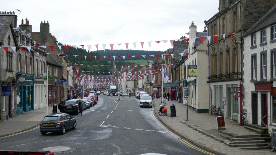
We really like Edinburgh! The word that springs to mind is ‘handsome’, the old and the not-so-old existing side by side. We enjoyed the inner-city streetscapes of three-storey buildings with a bewildering assortment of shops and cafes and services at street level.

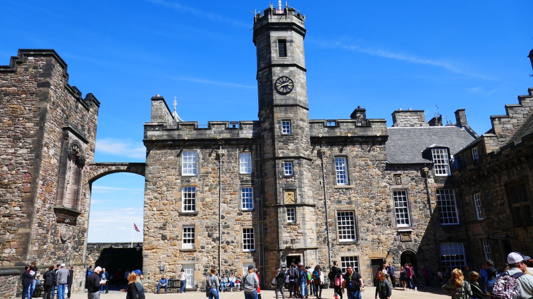
But our first destination was Edinburgh castle, high on a rocky promontory commanding stunning views over the city,. What stood out most was the complete absence of tall buildings; the New Town area north of Princes Street was almost a uniform height, lending a really pleasing and almost European feeling.

The castle is apparently the most-visited place outside London and we could see why. It wasn’t just the dramatic setting; within a small area is packed so much history and grandeur that its intensity is quite, quite stunning. The military and the regal is intertwined in a way we’ve not seen before.

And, quite by accident, Peter learned more about one of his ancestors.

One of the buildings, home to the Dragoons, had a display of their history. One of the exhibits showed examples of the medals given out during various conflicts, including the First World War. Quite coincidentally, just a week ago Peter’s aunt in Morpeth had showed him a couple of medals belonging to his mother’s father that the family believed were from the war – and here, in Edinburgh, he saw identical versions! A mystery resolved.

We wandered down the Royal Mile, an interesting area steeped in history though now lined with ways to part tourists from their money (not us though!) Tired and weary, we caught the bus back to our lodgings, later to enjoy a delicious Italian.

Distance walked: who knows?

Whiskies sampled – just the one (Aberlour)

Within the castle walls:

P1010586.JPG

Saturday 23 June – Uphall to Polmont

Originally we were to walk from Kirknewton to Linlithgow. In fact, our journey was somewhat different!

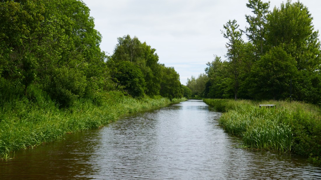
After a great Skype call to some of our NZ friends, we caught the bus into central Edinburgh and then the train to Uphall Station, the point we’d got to on Thursday. A 3km walk took us to the Union Canal, which we’d be following on and off for the next couple of days.

Regular readers of this blog will know of our deep love for canalside walking, so we were excited indeed to spend//// most of today doing just that. Though cool, the day was dry, an ideal walking day, one to savour as the forecast was for hot weather (27 to 28’C) in a couple of days. Much of the canal was lined with trees, resplendent in their foliage. The path was actually a long-distance cycle route so it was built to a high standard and was great to walk on. By 2.30pm we’d arrived at Linlithgow, so it was time for Plan C!

Originally we were to stop there, at the West Port Hotel, but tomorrow would be a gruelling 32km/20 miles and we knew it would not be fun. Our cunning plan was this: we spotted that both Linlithgow and the next station of Polmont were on the same train line, so we dropped off our packs at our hotel, walked on pack-less for some 7km to Polmont and caught the train back to Linlithgow. Tomorrow we will simply catch the train back to Polmont and start walking, turning the 32km day into a much better 25km day. Not only that, we were we back at our hotel by 5pm.

Distance today:  25km / 15.5 miles
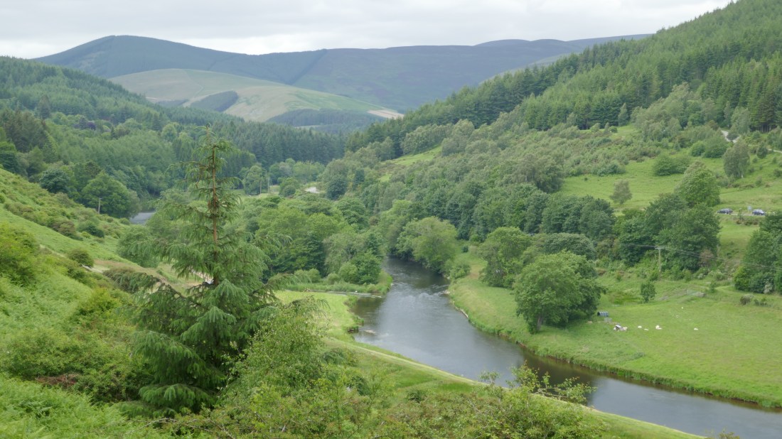
Union Canal:

P1010603.JPG


A summer solstice stroll

Thursday 21 June – Carlops to Edinburgh

Today is the longest day. Not distance, of course, but daylight. Today the sun rose at 4.23am and won’t set until 10.03pm. It will have been getting light from 3.30am and won’t get dark till past 11pm. That’s a lot of daylight! In fact, today we rose with the sun well up and will go to sleep with the sun still up. Most odd! We have also regularly been woken at 3.45am by the dawn chorus!!

And sunny it was – a real contrast given all the cloud we’ve had in the past week. We rejoined the Cross Borders Drove Road at West Linton, the path taking us through farmland and on into the hills. As we moved away from the farmland we were back out onto remote heather clad hillsides, today on the Pentland Hills, where even the sheep were few and far between. And not another soul in sight. Given how close we are to Edinburgh (15 miles at most) it was quite surreal to appear to be so isolated. We made the most of this stretch – about 12-13km (7miles) we will be in much more populous areas for the next little while. There were a few very wet areas after the rain but as with yesterday it was mostly a lovely easy track to follow, with gentle gradients.

As we came over the last saddle of the Pentlands we could see the outskirts of Edinburgh, and the newer bridge over the Forth. The pylons supporting the bridge looked like holographic pyramids in the sunshine – quite odd. The Drove Road descended gently down to its finish at the A 702 and from then on we were on quiet country lanes to take us through to Kirk Newton. Originally we were going to catch the train in to Edinburgh from there, but we had decided to continue through to Uphall Station – shortening Saturday’s walk a little. A well-placed newsagents provided the chocolate bars we needed to power us through the extra 6km (3.5miles).

A welcome comfy seat on a train for 20 minutes in to Edinburgh, and a short bus ride took us to our accommodation for the next two nights.  Tomorrow is a rest day for us – chores to be done (laundry!) and a castle to explore.

Distance today :  24km / 15 miles

Two views of the Drove Road through the heather-clad Pentland Hills

P1010552.JPG

P1010561.JPG


Unexpected discoveries

Wednesday 20 June – Innerleithen to Carlops

Today may have been a ‘fill in’ day but it produced a couple of unexpected discoveries which made the day quite enjoyable.

There had been heavy rain overnight, which had thankfully largely eased off while we were having breakfast. We have to say that the British really have this rain thing sorted: three times now when there’s been heavy rain, it’s been organised to happen overnight! We set off in a very light drizzle, the surrounding hills still with wisps of low cloud and mist. Actually, with the village being located in a particularly narrow part of the Tweed valley, surrounded by steep pine tree-clad hills with the mist, it had quite an alpine feel.

The OS map had indicated our route would take a rather long 3km detour east and south before we could resume our northwest track to Peebles, so it was great delight that a passer-by, noticing our packs and asking about our destination, told us ‘oh there’s a new footpath that will take you straight to Peebles.’ And so there was! It was actually a rail trail, following a former railway line, level (of course!) and tarmacked the whole 10km. A great start indeed, especially as it passed through some scenic stretches and by now the rain had entirely disappeared, though cloud and a chilly wind still lingered as it would for most of the day.

On the way as we passed through the village of Cardrona we noticed a number of houses decorated in red and white bunting, a couple even with a large photo of a girl and messages such as ‘immediate entourage’. We speculated as to what this might be. When we got to Peebles we saw a few more, with the main street festooned in banners. The reason? It turns out to be another Borders festival, this one called the Beltane, marking the return of summer and featuring a parade and the crowning of a young girl as  the Beltane Queen. Like the others we’d heard about, it is centuries old, had nearly died out, and had been very successfully revived. We only wished we could have been able to be in Peebles for the parade and festival!

Peebles itself is a handsome small town, its main street lined with a large variety of shops including a butcher’s – just as we like to imagine all high streets once looked. It’s set in a wide part of the Tweed valley, with hills around it. As we left the town we both thought how much we’d enjoyed our three or so days in Tweed-dale and how much we’d like to come back.

Our route out now took us onto the Cross Borders Drove Road, a centuries-old way formerly used to move livestock across the borders and on to the lowlands. That use has now gone and now it’s mostly a mix of farm tracks and paths, but its legacy remains in a wonderful path that weaves its way around and over the hills. Because it largely follows contours rather than heading straight up the hills, it’s a gentle walk. Often, too, it still has its own right of way between fences or stone walls, but sometimes there’s just the path across wide grassy slopes. For an hour or so, we were following it around one particular set of hills above a valley, almost devoid of trees, but quite scenic and certainly very peaceful, a small brook on the valley bottom weaving its way, glinting in the occasional glimpse of sun. Definitely another unexpected bonus!

There was still some distance to go, and by the time we got to West Linton the joys of the day had most definitely been overtaken by weariness. While our route would take us on from West Linton tomorrow, we weren’t actually staying there but at Carlops village, a 4km detour to the north. Fortunately Peter’d had the foresight to organise a taxi to pick us up, one of the smartest things we’d done given how weary we were by then! Our stay was at the Allan Ramsay Hotel, a quaint old pub named after a famous 18th century Scottish poet and artist – and yet another pub with a great whisky selection!

Distance today:  29km/17 miles. Whiskies sampled today: two!

Peebles:

P1010532.JPG
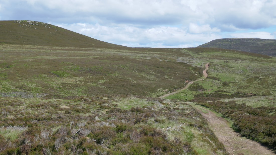
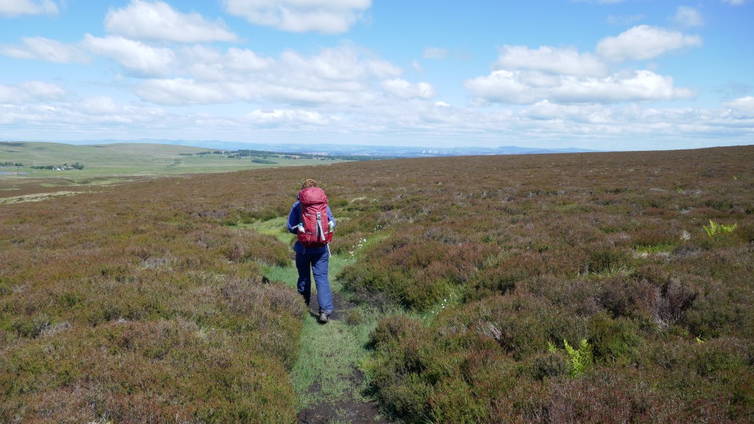
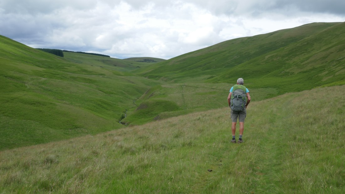
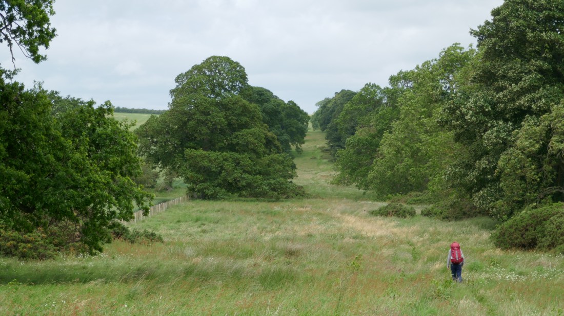
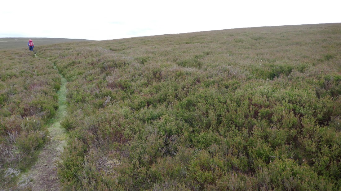
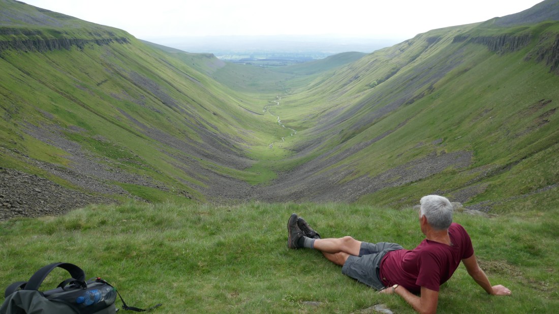
Walking the Drove Road

P1010543.JPG


Tweed Tales

Tuesday 19 June – Melrose to Innerleithen

We’d heard (vaguely) of the Scottish Borders and of course Peter had been here briefly in 2015, but we knew very little otherwise.

What we have come to realise is the wealth of history, sights and places to visit they have! It has to have more stately homes, abbeys, castles, festivals, places of historic interest and events per square mile than virtually any other part of the UK.

Last night was the perfect example, with the pipe band and the parade of horses. As we found out today, this wasn’t unique to Melrose: all through Tweed-dale there are all sorts of events and festivities this week.

We set out from Melrose, along the River Tweed, and soon came to its ‘big brother’, Galashiels. Just three years ago the railway link to Edinburgh was reinstated, making the town and its surrounding villages even more accessible. It struck us that, with a number of disused railway lines in the area having been converted to ‘rail trails’ and cycleways, there was real potential to encourage the sorts of short-term cycle and walk-based holidays we’ve seen in places like Central Otago in New Zealand. There’s certainly enough things to see, and places to stay!

Our nod to the countryside came in the form of the Southern Uplands Way, a long-distance path through the Borders. We followed it out and up, getting some lovely views, before descending to the Tweed. We decided not to follow the Way on its circuitous and very hilly path to Innerleithen, instead picking up the trail of Cycle Route 1 along a very quiet lane by the Tweed. Not only was it a lot more level and easy, it also had some truly scenic glades to go through. That’s what we call a win-win!

We’d heard about a shop selling delicious ice creams in Innerleithen – and as luck would have it, our path took us down the main street and right past it! Well, we just had to stop, didn’t we? Chocolate for Val, banoffee for Peter, most delicious. Just ten minutes after that we were at Glede Knowe, our B&B and a very fine place it is, too.

We had dinner in the Traquair Arms just down the road. We can certainly vouch for the steak & ale pies, but Peter was in seventh heaven when he saw their whisky selection – there had to be close on thirty different ones. Ah, bliss!

Distance today: 27km / 17 miles

Tweed-dale:

P1010514.JPG

What a difference a day makes

Monday 18 June – Jedburgh to Melrose

Today we were to follow a part of the St Cuthberts Way, a walk that Peter had completed over four days a few years ago. As we left Jedburgh on our way to link up with it we passed the ruins of Jedburgh Abbey. It is one of four great abbeys established in the Scottish Borders in the 1100s, but partially destroyed during various wars with the English in the Middle Ages and in the 1500s. As we have walked we have been aware that many of these small villages and towns we are staying in have any number of places of interest that need exploring, that we were previously unaware of. We keep saying “We must come back here one day”. And “Maybe we should have allowed 2 years for this walk so that we could explore more” !

Anyway…  We walked out of Jedburgh alongside the Jed Water and then out in to farmland before picking up the St Cuthberts Way. This took us across the River Tweed and in to some lovely deciduous woodland and then along the Roman road Dere Street, which we had briefly met yesterday. Dere Street and St Cuthberts Way joined forces for several kilometres, tracking close to the River Tweed.  Dere Steet is now a protected “monument” and so the route remains very clear, at times a definite 5-6m wide pathway stretching ahead of you.

Eventually the two routes separated again and we stayed with St Cuthbert, following the River Tweed through to St Boswell and Newton St Boswell. It was a tranquil, lovely and very picturesque scene. Our final section in to Melrose followed a cycle route – easy walking. Late in the evening, a final surprise: a parade through the streets by a pipe band followed by dozens and dozens of riders on horseback, all clad in formal riding gear, part of a centuries-old festival originally designed to secure the town boundaries.

Overall it was a really enjoyable day’s walking.  An undulating gentle route with plenty of variation, and such a contrast to the last section of our journey, along the Pennine Way.  In the past 24 hours we have left behind the high fells, the vast moorlands, the ‘surprise’ boggy patches, the curlews and lapwings. We are returned to the world of deciduous woodlands, fields of grain, undulating countryside, rivers, woodpigeons and chaffinches. One of the joys of this trip has been the ever-changing landscape as we walk up the country. We are looking forward to seeing what the next four weeks brings us.

Distance:  26km / 16 miles

Dere Street:

P1010484.JPG

River Tweed:

P1010497.JPG


Across the border

Sunday 17 June – Byrness to Jedburgh

Borders are funny things. In some parts of the world, they need passports, or are heavily defended, and it takes some effort to cross them. Others are not.

Take today, for instance, the day we crossed from England into Scotland.

We’d left Byrness bright and early, the Pennine way rising steeply out of the valley, almost a scramble at times. Soon we were atop Byrness Hill, with great views back over the valley to the south, before the path took us on a rolling up-and-down journey. To our east lay defence land, signs sternly warning us of the dangers of unexploded ordnance, open and wild moorland. To the west we could see the northern part of the Kielder Forest. And to the north? That way lay Scotland.

On the map we could see roughly where the border lay, and as we got closer we thought of what might have been had the independence referendum gone differently. Would we have been entering the Free and Independent State of Scotland? Would there have been a border post, manned by burly men trying to keep out the uncultured heathens (not that the Scots would ever call the English that, of course…).

In the absence of all that, while we weren’t exactly expecting a lot, we did at least think we’d see a sign alongside the Pennine Way, perhaps proclaiming ‘Welcome to Scotland’ or something similar. But… nothing. No opportunity to stand with one foot in England and the other in Scotland. Just another step on the Way.

We abandoned the Pennine Way very shortly afterwards. It would wind a further 30km northeast to its end in Kirk Yetholm. But our path lay northwest, so we descended off the hills, down into a valley and to a minor road by a stream.

The rest of the day took us along a succession of minor roads, tending northwest, through small hamlets. After three weeks of largely hilly terrain, it was a relief to be in relatively flat country. At one point the road followed the line of Dere Street, a former Roman road, straight like most Roman roads. To one side lay the former Roman camp of Pennymuir, just a grassy field now, and thus hard to picture it two millennia ago when it was a large bustling garrison town.

The only village of any note we passed was Oxnam, lying sleepily on a mid Sunday, no shop of any description to create any diversion (an icecream would have been just grand right then!). Our legs and feet tiring, it was with great relief that we finally got to the border town of Jedburgh and our accommodation for the night, Allerton House.

This is a grand old stone house that Peter had stayed in three years ago while walking St Cuthberts Way (a 4-day walk) and was keen to revisit. It did not disappoint, with a lovely big bedroom, a great dining room/lounge, and a whisky decanter to finish the night with. (Given the name of the blog site we had to celebrate our arrival in Scotland in appropriate fashion!) Surprisingly, we were the sole guests – and later we learned why: it turned out the proprietors had sold the business after a number of years and we were actually their last guests ever! It was only because we’d booked so long ago that we’d been able to stay; after confirming the sale of the business they’d decided to turn away others.

Dinner in Jedburgh took more effort than we’d bargained on, with both the two reasonable eateries booked out. The reason? Father’s Day. Choices being rather limited, our first dinner in Scotland was an average Indian in a decidedly average (and rather odd) Indian restaurant….

Distance today: 32km

Last of the boggy patches!

P1010446.JPG

The border is here… somewhere

P1010449.JPG


Back on the road again

Saturday 16 June – Bellingham to Byrness

It was so hard to get ‘back on the road again’ after two wonderful rest days with Gillian and Michael. We’d gone for Gillian’s Seven Bridges walk around Morpeth, crossing and recrossing the River Wansbeck, a delightful river indeed. We’d gone into Newcastle on the train for a whistle-stop tour, including Newcastle’s famous Millennium Bridge, dubbed the Blinking Eye by locals as it regularly opens and lifts up to allow shipping through (suggest you google it!). We’d had lots of family time, including with Peter’s two aunts, and lots of time to relax, even watching some World Cup football. (Thanks so much, Gillian & Michael!)

But we have more walking to do, so this morning it was time to get back on the road.

Gillian dropped us off at Bellingham, we shouldered our packs once more, and soon were back in the countryside, back on the Pennine Way, under a cloudy sky. The forecast was for the possibility of some rain.

The first part of the day was reminiscent of others, fields and sheep and moorlands and heather, nothing particularly remarkable but still peaceful and enjoyable. We weren’t particularly elevated so the walking was easy. A chilly wind sprang up, though, accompanied by the clouds lowering, and just after our lunch stop the drizzle started. It remained our companion for much of the rest of the day.

In the early afternoon we reached the outskirts of Redesdale Forest, part of a vast plantation forest occupying much of northern Northumberland including the even bigger Kielder Forest. We learned that combined it was the biggest forest in Britain and one of the largest plantation forests in northern Europe. While such forest isn’t exactly the most scenic, it at least provided a change, and for the rest of the day we walked along a forestry road all the way to Byrness.

To keep ourselves occupied, we came up with names for the ever-changing drizzle and mist that now dogged us, creating our own hierarchy. Lightest is ‘mizzle’ (a misty drizzle), which we’d picked up from Paul. A bit heavier and it’s ‘drist’ (drizzly mist). Then there’s drizzle, and next ‘’drain’ (drizzly rain). Still heavier, and it’s rain. You can probably tell by now that the forestry road wasn’t very interesting…

There is of course one further level, and it’s called – wait for it – a thunderstorm! And that’s just what happened to us, a mere ten minutes before we arrived at our B&B. The skies opened, the rain sheeted down, and a clap of thunder rattled around the hills. So we arrived a little on the damp side – though just then the rain stopped just as suddenly as it had begun, and within half an hour we had sunshine and blue skies. Now if we’d only been ten minutes earlier… never mind, we have wet weather gear, and everything dried quickly.

Surprisingly, we were the only people in the B&B, The Byrness, so we got star treatment – very welcome hot drinks on arrival, free run of the guest lounge, our choice of bathrooms, and to cap it off, a three-course meal so we didn’t even need to leave the house!

The thunderstorm did have one final act – a lightning bolt succeeded in taking out the power for a couple of hours for not just the village but quite a large area around. Fortunately our hosts had got dinner cooked, and had just finished baking the dessert (a delicious Greek orange cake) so it didn’t disrupt our evening too badly.

Distance today: 24km / 15 miles

The Pennine Way through moorland and heather:

P1010440.JPG


Rail to Roman

Tuesday 12 June   Alston to Haltwhistle

Today’s walk was the polar opposite to yesterday’s – no steep climbs, no fabulous views from high fells, no potential navigational hazards. Today we had chosen to temporarily abandon the Pennine Way and to follow the South Tyne Rail Trail. It was a lovely, pleasant, level trail and easy walking – just what we needed after the past few days, particularly as today we were back to carrying our packs for the first time in about two weeks! So it was good to break back in to that gently.

We picked up the trail in the centre of Alston, at the old railway station strangely enough. A band of mostly voluntary enthusiasts have restored a few miles of the track and run a (diesel, we think) train for visitors each day. So initially we were walking along side the railway track, but eventually that petered out and we were on to the trail proper. The surroundings varied from fields to stretches of woodland – very pleasant indeed. And it was another fine day.

One big surprise along the way was the Lambley Viaduct – a huge structure that carried the railway across the South Tyne River and valley. We knew there was a viaduct but weren’t expecting something quite that big!

We were able to follow the trail in to the outskirts of Haltwhistle, and then find our way over a second viaduct in to the town centre, where we had agreed to meet Peter’s cousin Gillian and her husband Michael. They had very kindly offered to drive all the way from Morpeth to pick us up, and then to drop us back the next morning, so that we could enjoy an extra night with them. Fabulous – we will have four nights to enjoy their company and what is more – four nights in the same bed!  It’s amazing how such a simple thing becomes a luxury! Bliss!

Distance today: 24km


Wednesday 13 June   Haltwhistle to Bellingham

Today was …….. well, overall best forgotten for Peter at least! A cold he had been brewing for a couple of days finally blossomed and sadly he had a miserable day. But fortunately for our Grand Adventure he ploughed on and we managed to get through what was a long days walking.

Gillian returned us to Haltwhistle and we picked up the Pennine Way again.  Walking out through the village we followed a river valley until we eventually picked up the path that took us up to join Hadrian’s Wall. As most of you are probably aware, the Wall dates back to approximately AD130 and was built by the Romans to keep the marauding barbarians restricted to the north, in what is now mostly Scotland. It ran from the Tyne on the east coast right across to Solway on the west coast – a distance of some 117km or 73miles – and would originally have been about 5m or 15feet high. An impressive structure by anyone’s standards!  There is still plenty of the wall and its associated milecastles (strongpoints where the Wall garrisons were billeted) to be found– some has been restored, some has been left “as is”. Along the way there are various information centres with exhibits and interpretation, and so this really is a popular tourist attraction. There were many walkers and day visitors around today.

Whilst fascinating to see, the big snag with the Pennine Way following the course of the wall so closely for about 6km (4 miles) is that there are many climbs and drops as it follows a natural escarpment – very reminiscent of the South West Coast Path but without the spectacular coastline! But at least it was at the beginning of the day! As we peeled off and dropped down to cross some moorland we were able to look back and see what the Wall would have looked like from a barbarian’s point of view – very imposing up on the ridge of the escarpment.

From then on the Way tracked across a mix of moorland, farmland and farm tracks. Towards the end of our day we peeled off the Way again and followed a country lane in to Bellingham (pronounced Belling-jam) where we had arranged to meet Gillian and Michael again.

By then we were very glad to be looking forward to two rest days. The last few days have been taxing and it will be great to have a break. We are also looking forward to catching up with Peter’s aunts and having a stroll around the pretty town of Morpeth, which sits on the Wansbeck River in Northumberland.

Distance today: 32km

 Lambley Viaduct

P1010398.JPG

Just Roman’ along…

P1010409.JPG


Higher and higher

Monday 11 June   Dufton to Alston

Of all the days, today was the one we expected would be the biggest challenge. We would be climbing the greatest heights, the peak being Cross Fell, at 893m the highest we would have reached. We would be ascending over 1000m in total today. According to our guide book, we would also face potentially our one real navigational challenge, finding the right route off Cross Fell, especially if the top was shrouded in cloud and mist. Plus the day would be some 32km long. We would also have some great views. So it’s fair to say that we woke with both anticipation and some nervousness. What would the day be like?

Oh joy! Sunshine and a largely cloudless day greeted us as we set out of Dufton. We expected the climb up to the first high point, Knock Fell at 794m, to be hard work, but it actually turned out to be straightforward, not too strenuous, and providing lovely views on the way up. Almost before we knew it, we had reached the stone cairn that sits atop Knock Fell, time to enjoy a breather in the sun. To the west in the distance were the Lake District mountains, between us and them a verdant valley with a patchwork of fields. To south and east lay uplands and moorland. And to the north – our route – were the next three hills we would go up, Great Dun Fell, Little Dun Fell and finally culminating in Cross Fell.

Fortunately each was connected by a high ridge, so the descents and ascents weren’t challenging, and they were relatively close together. In short order we walked from one to another, and by lunchtime were atop Cross Fell. It was odd knowing that we would probably never be as high again along the rest of our route – we believe that this is the highest point.

You might be expecting that England’s highest mountain outside the Lake District would be a steep climb and a real peak. In fact, the top is more like a domed plateau. At the top is a lovely four-sided stone shelter, guaranteeing a sheltered spot regardless of the wind direction, so it was a great place to stop for our lunch break, more than happy with our progress. And the initial descent, far from being a navigational challenge, turned out to be straightforward.

Great, we thought, now just the relatively level walk to Alston, what could be simpler?

It turned out to be a long, slow, tiring and boring slog along a gravel and often-rocky track for much of the way. We’d like to say there were some redeeming features, but there were none. Eventually we descended into the pretty little village of Garrigill for a reviving snack on its village green and then an altogether more enjoyable walk along the South Tyne River to Alston (though ‘enjoyable’ at the end of 32km has to be taken with a grain of salt….).

Definitely a day of two halves – and the conclusion to two of the longest and most challenging days we were likely to face.

Distance today: 32km/20 miles

View from Great Dun Fell to Little Dun Fell (foreground) and Cross Fell

P1010363.JPG

Looking from Cross Fell across the moorland:

P1010371.JPG


A wonderful place to be a walker

Saturday 9 June – Tan Hill Inn to Middleton-in-Tees
Sunday 10 June – Middleton-in-Tees to Dufton

Yesterday saw us leave Tan Hill Inn on its high lonely road, cloud and mist in the valleys below. The day was a mix of lanes, stony farm paths and footpaths across moors, no great scenic highlights, more a ‘fill in’ day. Not enough to write an entire blog about! We did however have a sumptuous dinner – at a restaurant specialising in French cuisine, a surprising and unexpected find in Middleton-in-Tees. And our B&B, Brunswick House, was oh so comfortable.

But today – ah, today! We were keenly anticipating it as all our reading had described several highlights – Low and High Force, Cauldron Snout and High Cup Nick. (Bet you can’t guess what each is from their names!) Today was also an oddity as we would actually finish further south than when we started, a sign of just how much the originators of the Pennine Way thought of today’s sights. It would be a long day, some 32km, but for once not all that hilly.

We set off westward along the Tees valley, walking through hay meadows adjoining the River Tees, a shallow but wide and fast-flowing river. It was a glorious morning, almost too hot in the sun, though around us we could see clouds starting to build.

The first highlight was Low Force around 10am, actually a low waterfall (‘force’ is from the Old Norse ‘foss’, waterfall), pretty in itself, but dramatically overshadowed a couple of kilometres upstream by its bigger brother, High Force, plunging some 22m through a narrow gorge.

The forecast had mentioned a high likelihood of showers from 11am on, and almost to the minute we could feel the first spots of rain. Would it amount to anything more? At first we thought not, but then the thunder started from a rather dark cloud to the north. Sure enough, soon the rain set in and out came our full wet weather gear, for the first time in weeks. We weren’t looking forward to the prospect of lightning and thunder and heavy rain continuing, particularly once we were on higher ground, but resigned ourselves to a wet day.

In fact, after half an hour or so of fairly heavy rain, it stopped, and with the exception of a couple of light sprinkles in the afternoon we were blessed with reasonable weather.

We were still following the Tees upstream, and by now were in a narrow valley with crags and rockfalls both sides of the river. The sun came out in time to warm and dry things, ideally timed for us to have our packed lunch by the river. Not far around a bend came the sight of Cauldron Snout, a fairly impressive waterfall, fed by water from a massive reservoir above. The path now became a short, steep scramble up rocks alongside the waterfall, fortunately not as hard as we were expecting or as scary as the climb up Pen-y-Ghent, much to Val’s relief!

The path took us up and away from the upper part of the valley, now the Maize Beck, before rejoining it. We then had a very gentle rise up to a low saddle,  until we suddenly emerged on the lip of High Cup Nick – a massive glacier-formed valley, ringed on three sides by steep cliffs and escarpments, with steep shingly slopes underneath descending to a narrow valley far below us. It was absolutely stunning and fair took our breath away! Worth every hour of the long walk to get there.

We sat for many minutes in the late afternoon sun, just admiring the view, before reluctantly setting off along the top of one escarpment, to begin our long descent to Dufton village and its YHA, our home for tonight, arriving at 6.15pm tired after a long day but very satisfied.

Distances: Saturday -26km, today 32km.

High Force:

P1010333.JPG

Lunchtime!

P1010338.JPG

High Cup Nick

P1010352.JPG