WE DID IT!!

P1020311

Monday 16 July

This was the scene this afternoon when, after 83 days and 1850 km / 1155 miles, we reached the famous John O’Groats sign, the end of our road.

It was hard to believe when we woke this morning that, by day’s end, we would actually be in John O’Groats. We set off under a grey, drizzly sky and indeed it continued that way for much of the day. After so much fine weather it was ironic that our last day should be so much like our first! But the rain cleared by mid-afternoon just as we arrived at John O’Groats.

It was a bittersweet moment – a special moment indeed, and the completion of a magnificent achievement, but also the end of twelve weeks of ‘life in a bubble’ and time to re-enter the real world. Time for the obligatory photos, a wander round, then a wait for the bus to Wick, where we are staying tonight.

Of course there have been times when it’s been hard going, but those times have been far outweighed by the many wonderful experiences, memories that will remain with us for years to come. Our route was deliberately chosen to avoid populated areas, so we’ve been able to enjoy so much of what is still a ‘green and pleasant land’.

This is our last Scrumpy to Scotch blog. Tomorrow, we’ll catch a train from Wick to Inverness (bliss!) and the overnight Caledonian Sleeper on to London, then down to Worthing for a few days before returning home to NZ. We’ve really enjoyed sharing some of our journey with you, and appreciate all the great messages and best wishes from you all. Whilst it wasn’t meant to be entirely a fundraising adventure we’d like to thank you for supporting the charities we’d nominated. It’s great that our enjoyment has also benefited others.

It’s been a Grand Adventure indeed!

To paraphrase the Two Ronnies, it’s good night from P and it’s goodnight from V.

  • Peter and Val


Almost there!

Sunday 15 July  –  Dunbeath to Watten – Day 82

Well, as we mentioned yesterday, today was going to be a long day – 34km – so we set off just after 8.30am, with a delicious breakfast on board and having waved goodbye to our packs. As they were being transported for us today and tomorrow, we have officially finished carrying packs on this Adventure, which we both agree feels wonderful !

The first stage of our journey took us back on our old friend the A9 for another 8 or 9 km (5 miles). Being a Sunday morning we had expected it to be extremely quiet but there was similar volume of traffic to yesterday. As we had already experienced though, there was plenty of room to get well off the road when necessary. There were a few sizeable settlements along this section – Latheron, Latheronwheel, and Lybster – as well as more farms of course. Complete with some gorgeous Highland cattle calves, which saw Val and a car load of tourists stop and reach for their cameras!

Just after Lybster we had chosen to take a minor road and head directly north towards Watten. In hindsight we could probably have stayed with the main road and travelled via Wick but of course we had no idea how quiet this main road was going to be. So off we set on this very, very quiet and open side road, with 21km walking ahead of us. Fortunately today was another cloudy, if slightly humid, day – in fact we also had some showers during the afternoon. Had it been full sun we would have baked – there was no shelter.

The first 6km is incredibly straight and travels through farmland, with farmhouses and dwellings scattered along its length. The immediate countryside was now largely flat and the road could be seen stretching out ahead of us. The second section ran through Forestry Commission land for a further 8km (5 miles), with conifers set back on either or both sides of the road. At the far end of this we also had a wind farm to our right, its giant turbines gently turning in the light wind. Then finally another open section which seemed to alternate between moorland and farmland, eventually leading us up to the minor A road on which sits the village of Watten. And our venue for tonight – the Brown Trout Hotel – a country inn looking very welcoming after eight hours on our feet.

And tomorrow is our last day!  We are of course very excited about that – completing this Grand Adventure will be just huge for us. It is hard to believe that we have actually almost done this! We have been very fortunate that everything has gone very smoothly for us. To have walked for 12 weeks, about 1850km / 1150 miles, with our only health issues being a couple of minor and short-lived blisters is very lucky. And of course the weather has been outstanding! We have had to wear rain jackets on may be 5 or 6 days only – and even then generally only for half days – the rest of the time the sun has shone. We could not have imagined that in our wildest dreams! (We have sock / shorts / t-shirt tans to take back with us).

Distance today:  34km / 21 miles

Ewe never know…

P1020282

We just had to have a cute animal photo

P1020262


The Antepenultimate One

Saturday 14 July – Helmsdale to Dunbeath – Day 81

A9a

In an ideal world, you get a great 8 hours’ sleep in a comfortable bed in a quiet establishment that cares about its guests.

Or you could get less than 6 hours, having chosen a pub, on a Friday night, that has a 1am licence, with your room right above the bar, and a bunch of rowdy locals in the aforementioned bar who showed no inclination to go home… we are really looking forward to being back in a familiar bed in a normal house! It fitted in with our experience that in many UK inns, often the drinkers come first, the diners second, and those staying come a very distant third. Mind you, that said, we did have two inns in our top accommodation list so may be that conclusion was coloured by the lack of sleep. : )

So your rather tired walkers set off, on a decidedly average breakfast, under cloudy skies, to walk the entire 24km along the A9. Excited? Us neither…

However… far from being a tedious, traffic-dodging experience, the day turned out better than expected. For some reason the traffic was really light – at one point the entire road was deserted and quiet for nearly two minutes – and with lovely grass verges to jump onto when we needed to. At times the road was more like the quiet ones we’d been used to and not the major arterial it is. And the weather was great, dry and clear and just the right temperature.

Even better was the lunchtime break at the River Bothy Tea Rooms in the tiny village of Berriedale, where we had coffees and the most scrumptious slice of coffee and walnut cake. Yum! Definitely recommended.

The countryside around us is increasingly moorland, with hills to our left and cliffs on the seaward side, with not a lot of habitation between the villages. Out to sea there is a drilling platform and some wind turbines in the distance – and a lot of open sea! The far north of Scotland as we expected it might look.

We arrived at our destination, Inver Park House just out of Dunbeath, around 2.30 – such a wondrous time. We could sprawl out, watching some great tennis, sipping hot drinks, and knowing that today was the last day of carrying our packs (we have arranged pack transfers for tomorrow and Monday – at 34km tomorrow was going to be hard enough as it is!). And our dining spot just down the road is already booked. Should be a lovely relaxing evening.

Distance today: 24km/15 miles

Just 62km/38 miles and two days to go!

UNUSUAL SIGHTS WE’VE SEEN

unusual signs


As seen in Hawes – apparently this farmer brings his tractor into town a lot! Must help with road rage…

tractor

This is a group of onion pickers.  Why are they wearing hi-vis vests?

onion pickers

No, it’s not that UK onions will leap up and attack you! According to someone we met, it’s so that the workers – all migrants – can’t skive off without being seen…


The best fish and chips….. ever!

Friday 13 July – Brora to Helmsdale – day 80

We were quite looking forward to today – it was going to be a nice short one! But we also knew that there would not be anything too exciting to see as it was mostly walking along the A9. Of course that in itself made it “exciting” at times – or should that be that it made the adrenalin pump at times, but for all the wrong reasons!

In all seriousness, the A9 has been much easier than we feared. The volume of traffic has been much less than anticipated, and of course the further north we go the less traffic there is – well, there are fewer places for it to be going to! So there have been spells of anything from 30 seconds to a minute and a half with no traffic in either direction – it’s really weird. But that does at least make our travel safer. Some stretches have been quite restricted in terms of road verges to walk on so the fewer cars and trucks the better we like it! At times the road is squeezed between the sea, the railway line and the hills – not much room for anything at all. It is great to be near the coast again though. And again today, the sea was like a mill pond.

It was a shame to only have the one night at Clynelish Farm – very comfortable, very welcoming and relaxing. As we had just a short day’s walk ahead we dawdled over our departure and were not on our way until 9.45am. Then we got delayed by a paddock full of excited lambs who all wanted to say hello – needless to say, Val stopped to do just that! The first couple of kilometres were on side roads, plus a short spell on a minor road at midday but that aside it was all on the A9.

We started the day under cloudy skies again but by lunchtime we actually had sunshine for the first time in about three days. Arriving in Helmsdale at about 3pm, we had a wander, and a coffee and then sat by the harbour in the sun for a while. Helmsdale is a fishing port at the mouth of the River Helmsdale on the east coast, and the village came in to being around 1814 when crofters were being resettled after the Highland Clearances. It seems the Highland Clearances is a term coined to encapsulate a period when many aristocratic landowners enforced a change from farming to sheep rearing on their lands, which of course lead to many crofters and their families having to leave their homes.

Highlight of the day (second to the lambs greeting me says Val) – the superb fish and chips at La Mirage in Helmsdale! Apparently voted in the top ten around the country by a celebrity chef type person some years ago – it really was very good! Our accommodation tonight is the Bannockburn Inn – average pub type set up, nothing glamorous.

Three days to go!

Distance today:  18km / 11.5 miles


FAVOURITE ACCOMODATIONS:

(Of course this lists excludes stays with friends and family which are always the very best!)

The Old Vicarage, St Ives – gloriously atmospheric and ornate B and B

The Lamb Inn, Sandford – pub luxury and full of character

The Belmont B and B, Bath – spacious, light and airy, guest lounge

The Falcon Inn, Painswick – 16th century coaching inn, more pub luxury

All the YHAs – character, amazing settings, some historic buildings, friendly staff

Ebor House, Hawes – beautiful room with a fabulous view, so welcoming and friendly

Glede Knowe, Innerleithen – another beautiful room, guest lounge, friendly welcoming hosts

Bracarina House, Invermoriston – lovely room, incredibly friendly hosts, great breakfast

Old Manse B and B, Dornoch – beautiful building, well converted to B and B, lovely bedroom, massive bathroom, guest lounge

Ghlasdruim B and B, Glencoe – another spacious room and the use of a lovely garden with outstanding views of the surrounding mountains, fabulous breakfast and two lovely dogs

Clynelish Farm, Brora – another older building with lovely room, the rural setting, fabulous lounge and wonderfully friendly and welcoming hosts


Val makes new friends:

P1020238

Walking the A9 north of Brora:

P1020241.JPG


Tar seal and common seal

Thursday 12 July – Dornoch to Brora – day 79

Unlike yesterday’s early start, breakfast was at a much more reasonable time, and we had the time to savour it. And it was good!

We departed under still-cloudy skies, though it would be a dry day. We’d loved our accommodation, The Old Manse, a gorgeous two-storey large old building, with lovely rooms and even a lounge for guests, and definitely one of the best places we’ve stayed at, but soon discovered that Dornoch had yet more wonderful-looking buildings. Many are of the local sandstone, quite reminiscent of Bath and the Cotswolds, providing a delightful honey glow to the village, with baskets of flowers outside.

The centre of Dornoch is blessed with several great old buildings, from the surprisingly-large church to an old castle right opposite, now a pub and information centre. Soon we were out and heading north.

The next three or four days are notorious among End-to-Enders. In this part of north-east Scotland the hills and moors come close to the sea, and with a low population there are few villages and therefore very few lanes or footpaths. As a result you have to spend much of your time walking along the busy, narrow A9 highway. Not exactly something we were looking forward to!

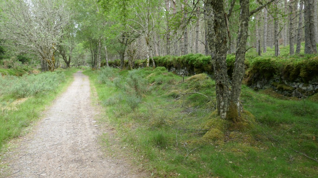
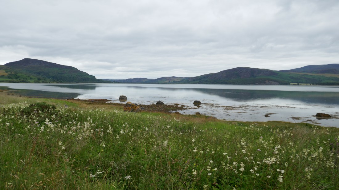
Fortunately the first part of the day was away from the highway, firstly along the trail of a disused railway line, then along a quiet road alongside Loch Fleet. This is a lovely, tranquil part of Scotland, a long, narrow, tidal bit of water and a haven for wildlife of all sorts, and hence a nationally-recognised and protected site. As well as all sorts of birds we even saw a few common (or harbour) seals!

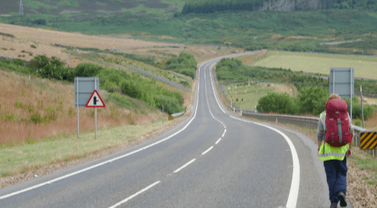
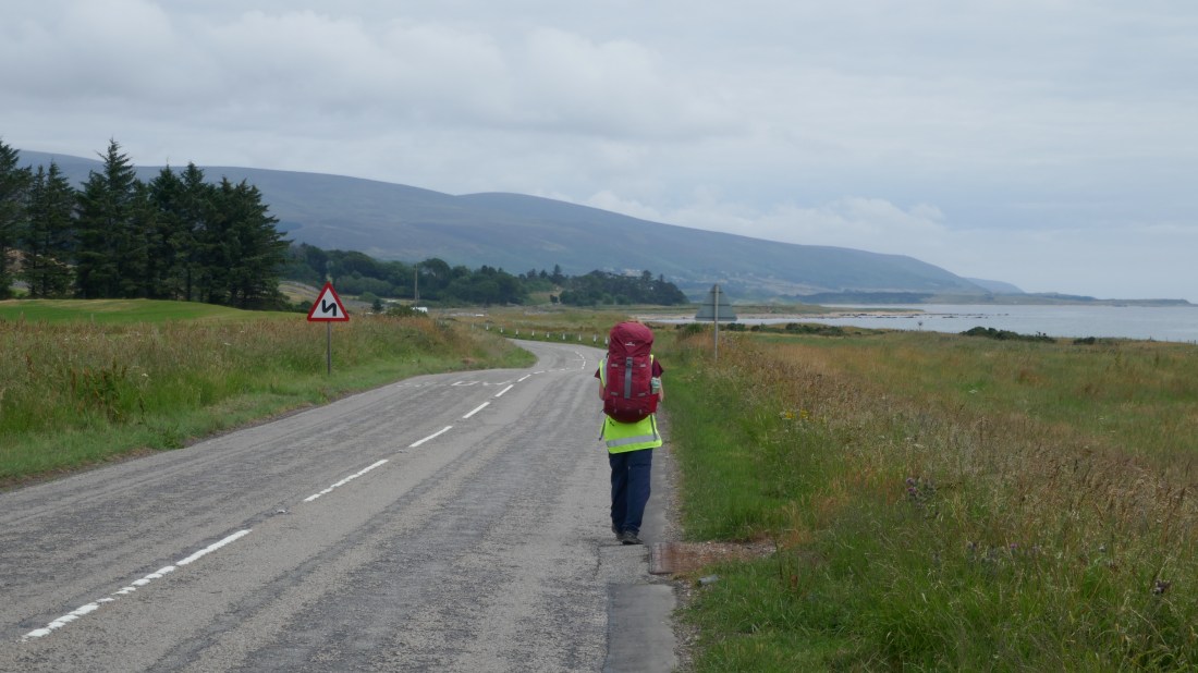
All good things come to an end, and our way took us onto the A9, which we would follow for several kilometres. While relatively busy and with only narrow verges which we had to jump onto when traffic approached, the road was nowhere as bad as we’d been told or had feared. The traffic tended to come in waves, leaving stretches of clear road that we could use to progress along. We even got used to the busy bits, even having large trucks go hurtling by just a couple of feet away! We were experienced in road-walking now, disciplined, both of us knew exactly what to do, we moved in unison, and both had bright lime yellow hi-vis vests on, so we were doing all the right things.

As luck would have it, we passed through the village of Golspie around lunchtime, and there was a café…. What good timing!

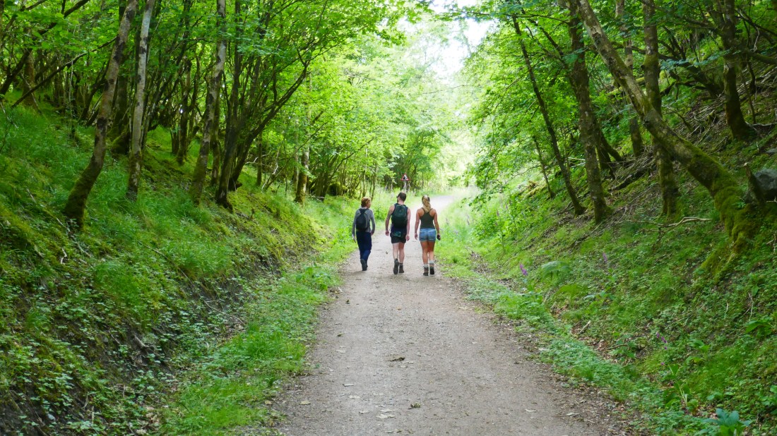
Then more good luck: most of the way from Golspie to our destination of Brora took us not along the road but along a coastal footpath, just metres from the North Sea. Despite its fearsome reputation, today the sea was almost flat, just tiny ripples disturbing its surface. We thoroughly enjoyed these few kilometres, sea to our right, grassy soft path underfoot.

Partway along we passed the fantastically-ornate Dunrobin Castle, all turrets and spires, looking like something Walt Disney might have created. It’s the biggest house in the northern Highlands with 189 rooms (imagine the poor cleaners!) and was built by Charles Barry, the chap who also designed the Houses of Parliament in London.

Not long after that we forsook the coast for the A9, taking us into Brora. We aren’t actually staying in Brora but at Clynelish Farm, a couple of kilometres out of town. After 28km on foot we were definitely not interested in the thought of walking back into town for dinner, so picked up bread and crackers and cheese for an impromptu ploughman’s lunch. As it turned out it was the perfect choice: our lovely hostess Victoria (who it turns out is an Australian who came over here backpacking and never left!) gave us plates and cutlery and we could sit in the dining room, overlooking a field full of sheep; very peaceful and rural.

The homestead is a wonderful old large two-storey building with lovely rooms, and even a large lounge with the most wonderful chairs. Even better – for Peter – there was a whisky decanter – for right next door is the Clynelish Distillery! Peter reluctantly partook of a dram…

Four days to go!

Distance today:  28km / 16.5 miles


FAVOURITE WHOLE DAY WALKS:

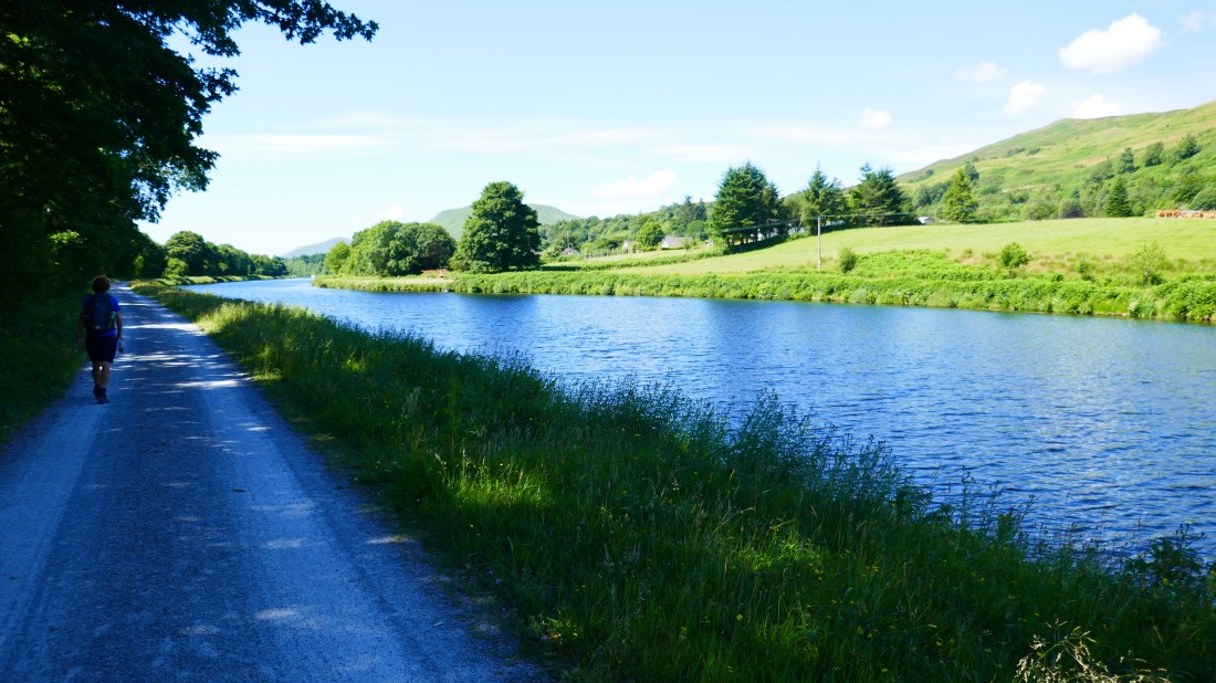
Forth and Clyde Canal

Middleton-in-Tees to Dufton – Yorkshire Dales, part of the Pennine Way with High Cup Nick as the dramatic finale

Winchcombe to Broadway – Cotswold Way, gentle walking with lovely woodlands, beautiful Cotswold scenery and the Mount Inn at Stanton with great views at lunchtime

Melrose to Innerleithin – Scottish Borders, lovely farmland walking and then country lanes following the river – oh, and an ice cream at the end…

Portreath to Perranporth – Cornwall, relatively easy walking along the South West Coast Path with the divine Trevaunance Cove in the middle

Crowden to Diggle – Peak District, lovely moorland walking with great views above a deep valley
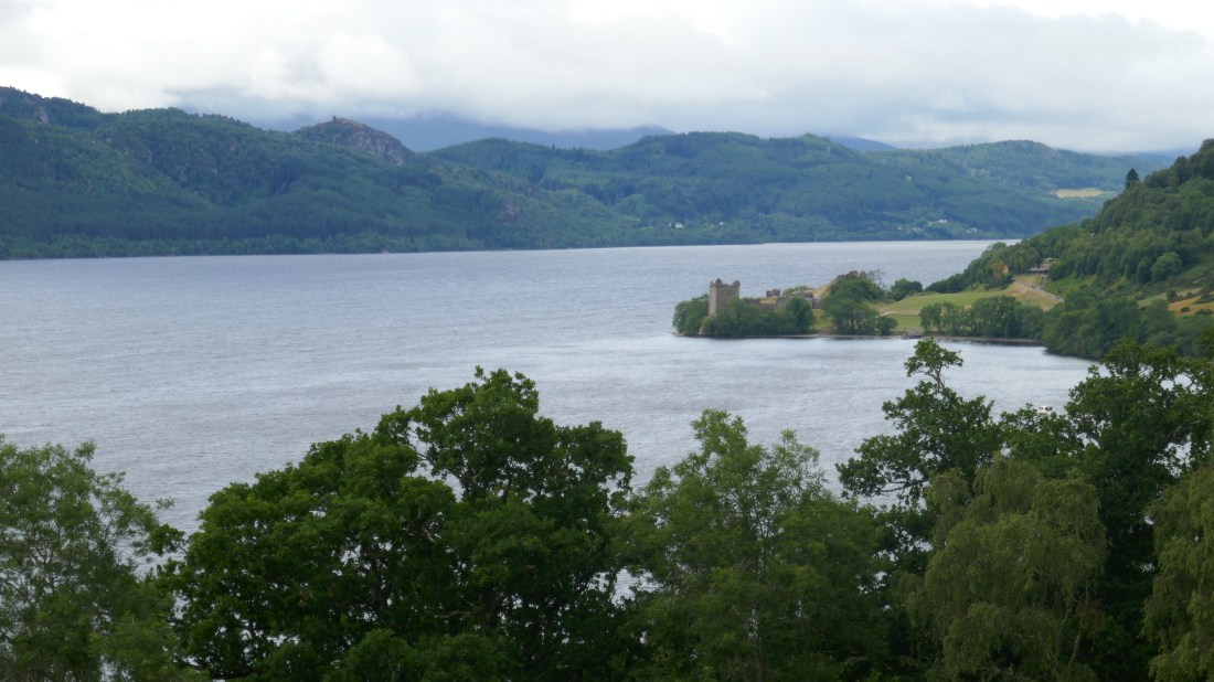
Loch Fleet

P1020212

Dunrobin Castle

P1020225


Winding roads and whisky tours

Wednesday 11 July – Alness to Dornoch – day 78

We knew today would be a long day, and we had to get to a point about 22km away by 2pm, so we went for a very early breakfast and go off to our earliest start yet – 7.40am! With Val still yawning (Peter was OK; he had had the benefit of coffee!) we set off along minor roads on our way towards Dornoch.

Our morning’s walk was all minor roads, nothing very exciting to report really. The only village we went through today was Tain, where we found the lovely Sunflower Café, serving hot drinks and tasty scones and shortbread – a welcome break after about 20km of walking. The café certainly lived up to its name – sunflower yellow décor with everything inside continuing the sunflower theme – cushions, pictures, cruet set, you name it, it had sunflowers on it !

And so to the big event of the day – a tour of the Glenmorangie Distillery! Peter was indeed a happy camper when he realised that this could be included on our itinerary, as he loves their whiskies. You have to book the tours, hence our need to be there for 2pm. And it was well worth it. We had a very entertaining young tour guide to show us around, and of course at the end you get to sample the product! A wee dram was served to each of us, with instructions on how best to savour the smell and taste.

From here, it was just another 12km to our destination. (If you say it quickly it doesn’t hurt your feet so much!) We did manage to get away from the roads a little, with a bit of time cutting up through a farm track, but mostly more minor road walking until we reached the bridge over Dornoch Firth. We had to join the A9 and all its traffic for a couple of kilometres in the run up to the bridge. Fortunately the bridge itself had a nice pedestrian friendly pavement, then back to roadside walking until we could cut back to another minor road to take us in to Dornoch itself. By 5pm we were very glad to see our accommodation for the night – The Old Manse B and B – a fine looking building dating back to 1883.

A quick shower and change and off in to the village centre to grab a table and some food at the local before ‘the big game’ started – yes, England vs Croatia was on tonight and we knew it would be busy anywhere that was screening the game! Our meals at the Eagle Hotel were excellent, the service was fabulous, and England played well but sadly lost.

On the plus side, our quick peek at Dornoch showed it to be a very good-looking village, sandstone buildings, wide streets decorated with hanging baskets, a thirteenth century cathedral (the smallest in Scotland we believe). Yet another place worth a second visit and further exploring!

Five days, 132km / 82 miles to go!

Distance toady: 32km / 20 miles.

 OUR FAVOURITES

Favourite half-day walks:

Dovedale, Peak District
Gorgeous valley walk following the River Dove

Fort Augustus to invermoriston, Great Glen Way:
Superb views out over Loch Ness

Any canal walks
Always a favourite – tranquil and peaceful

Bridestowe to Okehampton, Devon
Along the Granite Way following an old railway line by Dartmoor (In fact, any rail trail would also do!)

Hidden Valley (Kinlochleven to Fort William, West Highland Way)
The Scottish version of a walk in the Swiss Alps

Devil’s Staircase (Glencoe, West Highland Way)
Fabulous views of Glen Coe

Dufton to Cross Fell, Pennine Way
The high point of the walk

Cotswold Way
Any half day would do


The one without a name

Monday 9 July – Tore to Inverness – day 76

What’s this? we hear you say. Wasn’t today meant to be a rest day? Well, it was, originally – but tomorrow was scheduled to be a torrid 40km and there is no way we could have coped with that, especially with packs, so we decided to walk a bit of the route today and ‘bank’ those kilometres against tomorrow.

Fifteen minutes after boarding the bus in Inverness, we were at the Tore roundabout north of the city, for our 12km/8 mile walk back under cloudy skies. There’s not much to say about the walk: the first part was along a quiet country road, but the second part took us along the very busy A9, over the Kessock Bridge high above the Moray Firth, and past the port into the city.

The clouds were breaking up as we walked along the River Ness, a very pretty entrance to the city, with the sparkling waters on one side, and the various churches of central Inverness on the other. In the sunshine it certainly looked every inch a city, and a handsome one at that. We had a spot of lunch with a New Zealand friend, Naira, by coincidence over here for a holiday – how odd to meet up with someone from home on the other side of the world! A wander round the cobbled inner streets of Inverness revealed yet more of its charms, before the inevitable rest-day laundry beckoned. Dinner was in a tiny but wonderful Italian restaurant called Little Italy – so great that we booked a table for when we are back next Tuesday!

We really like Inverness, and as we’ve found before, wish we’d had more time. We will be back.

7 days to go

Distance today: 12km/8 miles
1663km / 1039miles covered. 186km /116 miles to go


Tuesday 10 July – Tore to Alness – day 77

Well, the great weather had to end sometime, and today was the day.

We awoke in the early morning to heavy rain, which fortunately had eased off to drizzle by the time we left our lovely B&B. Shouldering packs for the first time in a few days was a rude awakening! Back to the bus station, back on the bus to Tore roundabout, and so we resumed our progress north.

The day held few memories: alternating mist, rain and drizzle; country roads at first, then 2km crossing the bridge carrying the A9 road over the Cromarty Firth, trucks and cars swishing by close to us, occasionally covering us in spray. Not exactly a lot of fun! And the low cloud and rain blocked the lovely views of the Firth that we have seen on postcards. Ah well – we cannot complain after eleven weeks of mostly glorious weather! Fortunately we were soon back onto a quiet country road, the rain finally stopped, and the road frequently went through wooded sections, so it became a lot more enjoyable for the final leg into the village of Alness. It still brought John O’Groats 22km and another day closer – now just 6 days to go!

The next few days won’t have many attractions, which will lead to rather short blogs… so each day starting tomorrow we’ll recap for you some of our top things along the way, from best walks to favourite accommodation to most unusual sights.

Distance today: 22km /14 miles). 1685km / 1053 miles covered. 164km /102 miles to go

Inverness


The last of the Way

Saturday 9 July – Invermoriston to Drumnadrochit

Both our guide book to the Great Glen Way and our host at Invermoriston told us that we would get more great views of Loch Ness and would enjoy today’s walk. But to be honest we did not feel it lived up to expectations. – or maybe the day did not stand a chance after yesterday’s stunning views!

Naturally enough, having ended yesterday’s walk with a big descent in to Invermoriston, today’s began with a big climb back up again! We gained height fairly quickly, back up in to the pine forests, but continued to climb for much of the first two hours. It was another warm day, and we were glad of any shade afforded by the trees at times. There were also some open areas with great views back towards the peaks of the Glen. It is always surprising to look back and see just how far we have walked!

We also passed a couple of unusual sculptures – the Viewcatcher, a circular structure made of curved pieces of Caledonian pine creating a picture frame, and then the whimsically-named Troll Bridge, whose handrails were entirely made of bendy sticks.

About half an hour in we were passed by a couple of runners, wearing numbered bibs, then a couple more, then a couple more ….  So we asked one of them what was going on. It seems today was the Great Glen Ultra– an ultra-marathon running the Great Glen Way! That is 72 miles – and the start time from Fort William?  1am ! Crazy people!  So they were a bit over half way when they started passing us, and we were still being passed at 2pm by some of the slower runners / walkers of the original 82 who started! Quite a challenge indeed, especially in the hot conditions. We were in awe.

There was no running involved for us today – no surprises there! After our long ascent we were finally rewarded with a big view of Loch Ness. We could see back to Fort Augustus, and even still identify Ben Nevis. We still couldn’t quite see the other end of the Loch though – it is so vast! Sadly, almost as soon as the views appeared they were lost as the path cut down through more pine forests, and eventually to some rough farm land. Here we were following a farm lane, with hills between us and any possible views of the Loch. This then wound through some moorland before we descended through yet more pine forests in to Drumnadrochit.

Today was only about 23km and with little to stop and gaze at, or to hinder our progress, we arrived in good time at our destination, a backpackers’ lodge on the edge of town. We were in time to watch the World Cup match England vs Sweden at 3pm, which they were showing in the lounge –  an unexpected bonus. Even better – England won! There are lots of very excited English now eagerly awaiting the semi finals.

Sunday 10 July – Drumnadrochit to Inverness

This was our last day on the Great Glen Way. From here on we are mostly on road walking, so we made the most of this off-road day. We knew it would be a long day, and so were on our way by 8.20am after an early breakfast, under cloudy skies for a change.

It took us a couple of miles of road walking to get through to the other side of Drumnadrochit, a small town with a lot of new houses being built, and whose self-professed claim to fame is to be the centre for “everything Nessie”. Then we were back up in to (can you guess..?) more pine plantations. It has to be said though, this was a nice walking track, climbing upwards but easy walking on a soft carpet of pine needles. On the way up the hill we did have a view back along part of Loch Ness, and of the ruins of Urquhart Castle sitting on a little spur of land jutting out in to the Loch. They have found evidence of a Pictish Fort there dating back to 580AD, but the castle there now was built in the 13th century and was the scene of frequent battles between the Scots and English.

From here we were back to a forestry road through Abriachan Community Forest before joining a minor road through moorland. Still quite a lot of ascent involved but nothing too horrendous for old hands like us! Our only views at this point were out to the north, across to Beauly. Sadly we have probably seen the last of Loch Ness (and not a monster in sight – apparently she is more likely to appear after about 5 single malt whiskies…..)

And so on to a new forest path through some Caledonian forest before meeting another old friend – a drovers’ road. The Highland cattle were moved south along this route on their way to markets in Falkirk, or even further south. This one travelled through more forest and plantations before reaching Leachkin on the outskirts of Inverness. By now we have had glimpses of Beauly Firth and of Inverness and we start our descent down in to the city. We are amazed at how much new housing is also being built here, and our hostess, Roz, tells us that Inverness is doing well and certainly in a growth period. Good to hear.

A long day, but such straightforward walking and, again, sadly not much to distract us. So we arrived at Glenuig B and B at about 3.30pm. And we have a small sofa in our room – bliss!  We could relax with a cuppa before getting ready to go hunt dinner. Tonight we found a lovely little Spanish restaurant and enjoyed tapas – yum !

Just eight days to go now…

Distances:  Saturday – 23km / 14 miles

Sunday    – 32km / 20 miles

The Viewcatcher:

P1020148

Loch Ness

P1020152

Urquhart Castle:

P1020158

The drovers’ road

P1020167


Lochs and locks

Friday 6 July – South Laggan to Invermoriston

Today was a long day, some 33km. But it was one of the best days of our entire end-to-end walk.

Under yet another cloudless blue sky, we left our lovely B&B to meet our friends Scott and Isabel outside their hostel just down the road as they were joining us for the first part of the day. The sun was shining, there was no wind, the air was pleasantly cool though promising a warm 22 degrees. Indeed a great day to be walking!

The first half an hour took us along the Caledonian canal, but we were soon walking along the shores of Loch Oich. By now the Great Glen Way had picked up the route of a long-abandoned railway line, so as you’d expect the path was wide and level. To our left we could see glimpses of the loch through the trees, while to our right the trees rose up the hillside. From time to time we passed an interesting feature, an abandoned farmhouse or a short stretch of tunnel or even a railway station being lovingly restored. Most of the way we were walking through a tunnel of trees.

At loch’s end we then met a short stretch of the Caledonian Canal, crossed at that point by the A82 road via a swing bridge which allows tall vessels to proceed up and down. While we were there, we were treated to the sight of the bridge swinging open, slowly rotating on large wheels, while the traffic built up. There was something quite appealing about seeing modern transport having to stop to give way to a much older way of travelling!

At the same point was a cable-stayed cantilever bridge, till the 1930s the only way to cross the adjoining river, and a fascinating example of engineering ingenuity.

Our path then took us for some kilometres along the side of the Caledonian Canal, which would take us to Loch Ness. Alongside us was the river Oich, which drains Loch Oich into Loch Ness. At one point the canal descended through a couple of locks, and the grassy lawn proved a great place to rest for a bit, eat some food, and watch a trio of boats navigate the locks.

The canal took us into the small town of Fort Augustus, located where the canal enters Loch Ness via a flight of six locks. It’s a natural place for people to gather, refresh themselves – as we did – and simply chill out, watching the world go by. At this point we farewelled Scott and Isabel, who would catch a bus back to South Laggan.

The final part of the day was the 15km walk to Invermoriston. It could have been a slog, it could have been boring, but in fact it turned out to be one of the absolute highlights of our entire walk! The Forestry Commission has created a brand-new, high-level alternative to the old (but still open) Way along Loch Ness, and in doing so gave us a truly gorgeous walk. The path rose quickly out of Fort Augustus via a conifer plantation, but soon we were in the open moorland, high above the lake.

The Way meandered up and down but reasonably level – and my, the views were to die for! To left and right lay Loch Ness, and we could start to appreciate its immenseness – it’s some 37 miles end to end, virtually dead straight. It’s so long that we couldn’t see it all. It’s not Britain’s biggest lake in area – that honour belongs to loch Lomond – but it’s depth means it holds more water than all the lakes in England and Wales combined. And the makers of the new route (opened only three years ago) thoughtfully placed large slabs of stone at particular places, so you could sit and soak up the views. Which we did – frequently!

All good things come to an end, though, and eventually the path took us down a steep slope to the small village of Invermoriston. Our B&B, Bracarina House, turned out to be one of the best we’ve stayed in, a lovely, smart and very welcoming place. Even better, it was just a few metres from the local pub! A tasty dinner, sitting in the early evening warm sun, a lovely ale and a couple of great whiskies later (for Peter), one of the best days ever on the walk drew to a close.

Distance today: 33km / 21 miles

The rail trail:

P1020071.JPG

The Bridge of Oich:

P1020087

high above Loch Ness:

P1020127


The Great Glen

Wednesday 4 July – Thursday 5 July :  Fort William to Gairlochy to South Laggan

Wednesday 4 July

When we leave Fort William we are walking the Great Glen Way over five days. This 79 mile / 127 km Way connects Fort William to Inverness and tracks a path up the Great Glen.

A geological fault line runs across Scotland in a diagonal line between these two towns, giving rise to the peaks of the Highlands. During the ice ages, huge glaciers filled the valleys between these peaks, and as the ice receded it gouged out the fault in a long, narrow glen, the Great Glen, leaving behind the Lochs that lie within the Glen.

The combination of low altitude and the lochs made the Glen an ideal transport route. In order to facilitate transport of goods between the coast out past Fort William to the west and Inverness in the east, famed engineer Thomas Telford was engaged in the early 1800s to design and build the Caledonian Canal to link these Lochs. The Loch and Canal system were large enough and deep enough to allow free movement of sea-going ships, thus allowing them to avoid the hazardous journey around the northern coast of Scotland. While the Canal’s original role has largely ceased, it’s been reincarnated as a brilliant pleasure boat, cycle and walkway – the Great Glen Way.

As we mentioned in yesterday’s blog, we had decided to use our second rest day in Fort William to get a head start on our long haul through to South Laggan. So we caught a bus out to Gairlochy and walked back in to Fort William. Well, to be more precise, we caught the bus to Spean Bridge, 3km further out, and walked from there as there was no direct bus service.

Once we were at Gairlochy it was a very straightforward 16km (10 miles) back in to town. This section of the Great Glen Way follows the Caledonian Canal for most of its length apart from the final 2-3kms in to Fort William itself. So it was level easy walking with pleasant surroundings. This time, as well as the canal we had the bonus of hills and peaks around us as well. As the Canal connects the large Lochs and is both wide and deep, the craft we saw were quite different from our previous canal experiences – motor launches, masted sailing yachts, but no narrow boats.

Just 4km outside Fort William the Canal has a series of eight locks in a staircase, known as Neptune’s Staircase – the longest lock staircase in Britain. We had hoped to be able to watch lots of activity here, but sadly there were just two small craft nearing the end of their descent. A little disappointing, but we were able to overcome our dismay with diversionary tactics – coffee and cake! Enough to see us through to the end of our walk.  It was such good walking that our 19km walk was completed by 2pm, leaving us with time to catch up on emails (Peter’s work stuff), postcard writing, blogging and watching Wimbledon before a delicious dinner at a seafood restaurant on the wharfside.


Thursday 5 July:

Our day started with the bus trip out again, to rejoin the Great Glen Way at Gairlochy and this time walk on towards South Laggan. The walking was quite different today though – almost immediately the path climbed up to join a path through the beech woodland as the Canal runs in to the first of the Lochs – Loch Lochy (yes, really !). The path winds round the edge of the Loch, past some huge houses, and eventually sadly joins a forestry track that runs just high enough above the Loch that there are not many views. It was quite a long trek through the conifers. But our little guide book gave us a great spot to look for, where we could get to the water’s edge and enjoy superb views of the Loch sparkling in the afternoon sun – yes, it has been another glorious sunny day! We spent about half an hour soaking up the view and peace. Lovely.

Just a couple of kilometres (1 mile) from our destination the Loch ended and the Caledonian Canal took over again. We were headed for Laggan, a very small settlement on the Canal. Essentially there is a hostel, a B and B, and a bar on a barge!  That is it! But our B and B, Forest Lodge, proves to be a fabulous place, and our hostesses Lorraine and Laura are very welcoming. We are sad to only be here one night!

Tonight we were able to meet up with friends from New Zealand – Isabel and Scott have been on their big OE for almost a year now, and have taken a week in Scotland mainly so they could meet up with us. It was fabulous to catch up with them – they cooked us dinner at their hostel – and they are going to walk with us for part of tomorrow! Thank you – we really appreciate it.

Distances yesterday and today: each 19km/12 miles.

The Canal, looking west:

P1020028

Loch Lochy:

P1020049