Friday 1 June – Diggle to Hebden Bridge
The forecast for today hadn’t been too promising: extensive cloud (ie fog for us), and possible thunderstorms for the afternoon. So it was a surprise to have the sun greet us in the morning with plenty of blue sky.
Unlike the past few days, today didn’t start with a climb out of a valley, for we were starting off relatively high up. We were glad about that! It was straight out and into moorland, following the Way northwards along the edge of an escarpment, past Close Moss and Castleshaw Moor, up and over the heather-clad White Hill. Far below us, off to the west, we could see a number of reservoirs, watering Manchester and its satellite towns.
After a couple of hours of stillness, the peace was shattered by the M62 motorway, its six lanes of noise a real assault on the senses. We crossed it on a rather beautifully-designed arched bridge, constructed especially for the Way when the motorway was built. Apparently the head of the project was a keen walker and wanted to ensure fellow walkers had a fitting crossing.
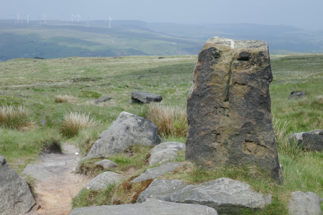
Leaving the motorway and its noise took some time, but eventually we were once again surrounded by rolling moorland and just the occasional bird call. At one point we passed the Aiggin Stone – an ancient marker stone that has been guiding travellers for about 600years. The path took a short diversion, going along an ancient packhorse road. Our book said the reputed Roman origins of the well-worn stones that paved it was ‘unproven’, but we liked to think they were the real thing.
By coincidence we passed a pub around lunchtime – time for a coffee and a delicious piece of apple pie. Suitably refreshed we progressed along probably the least interesting part of the day, a gravel track passing several reservoirs, originally constructed to provide water for canals but now principally a source of water for Lancashire.
For some time we could see a tall monument, Stoodley Pike, high on a headland overlooking the Calder Valley. It was built in 1815 to commemorate the defeat of Napolean at Waterloo. Although it collapsed in 1854 it was rebuilt, and at 120 ft (34m) tall it is a landmark that can be seen from miles away. Also, it apparently marks a change in the landscape too – with the peat moors and gritstone to the south and the limestone and more pastoral areas to the north. We sat on a grassy slope below it, enjoying the panoramic views, before descending to the valley and following the Rochdale canal into the village of Hebden Bridge and our accommodation, The Smithery.
Distance today: 24km
Below: the Aiggin Stone